Bought a Drone Recently? Here’s How to Verify If It’s Not Refurbished
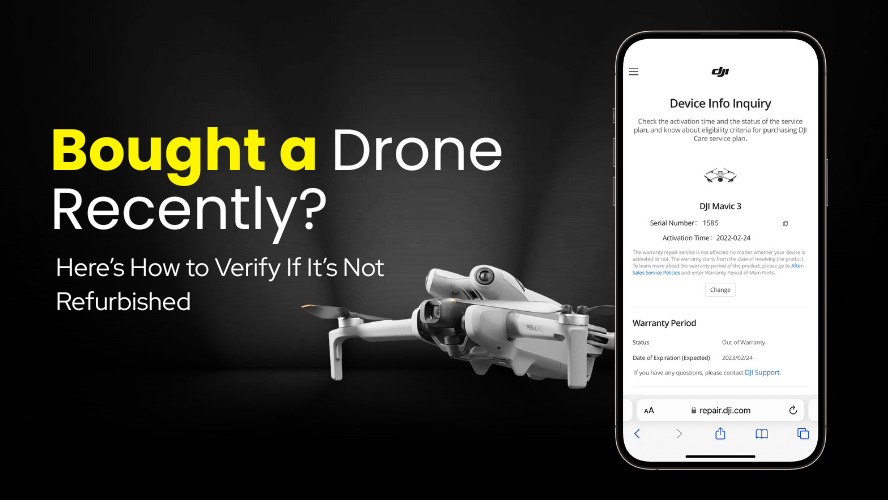
1. The Hidden Truth Behind “New” Drones That first unboxing moment is priceless — but is everything as brand new as it seems? You’ve just bought your first drone. It arrives sealed, the box looks fine, and you’re ready to take off into the sky. But a small doubt creeps in when something feels… off. …
Bought a Drone Recently? Here’s How to Verify If It’s Not Refurbished Read More »