Author

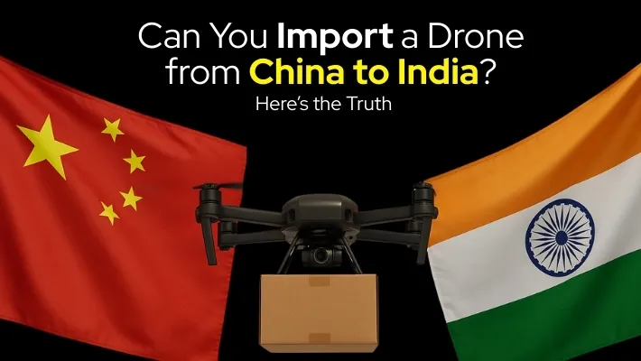
Can You Import a Drone from China to India? Here’s the Truth

Picture this: You’re browsing through the latest DJI drone deals on AliExpress, tempted by prices that are ₹30,000-50,000 cheaper than Indian retailers. Your finger hovers over the “Buy Now” button, but a nagging question stops you – can you actually import a drone from China to India? The answer might surprise you, and it could save you from a costly mistake that thousands of Indians make every year.

The drone import landscape in India has undergone dramatic changes, and what was once a straightforward process has become a complex maze of regulations, restrictions, and potential pitfalls. Whether you’re a professional photographer, surveyor, or drone enthusiast, understanding these rules isn’t just important – it’s essential to avoid legal troubles and financial losses.

The Current State of Drone Imports in India

Complete Import Ban Since 2022

India implemented a complete ban on drone imports in February 2022, fundamentally changing the landscape for drone enthusiasts and professionals. This decision was driven by security concerns and the government’s push to promote domestic drone manufacturing under the “Make in India” initiative.

The ban is comprehensive and covers all categories of drones, regardless of their intended use – whether recreational, commercial, or research purposes. This means that the days of ordering drones directly from Chinese manufacturers like DJI, Autel, or other international brands are effectively over for individual consumers.

What This Means for You

If you’re planning to import a drone from China:

  • Your drone will likely be confiscated at customs
  • You may face penalties ranging from ₹50,000 to ₹1 lakh
  • The confiscated drone will not be returned, even after paying fines
  • You could face legal proceedings for importing prohibited goods

For existing drone owners:

  • Drones purchased before the ban can still be operated legally
  • Registration with DGCA through the Digital Sky platform is mandatory
  • All flight operations must comply with current drone regulations

Understanding India’s Drone Categories and Weight Regulations

One crucial aspect that many drone operators overlook is how your drone’s weight decides what rules you follow. The DGCA has established five distinct categories based on weight, each with specific registration requirements and operational limitations.

CategoryWeight RangeRegistration RequiredKey Restrictions
NanoUp to 250gNoFly within line of sight below 50 feet
Micro250g – 2kgYesFly below 200 feet within VLOS, avoid populated areas
Small2kg – 25kgYesRequires remote pilot license, detailed compliance
Medium25kg – 150kgYesCommercial license mandatory, strict operational limits
LargeAbove 150kgYesRequires special permissions, restricted operations

This weight-based classification system is crucial because it determines not just your registration requirements, but also your operational freedoms and compliance obligations.

The Economics of Drone Ownership in India

Cost Comparison: Import vs. Domestic Purchase

Here’s a realistic breakdown of costs if you were to attempt importing versus buying domestically:

Attempting to Import (High Risk):

  • DJI Mini 3 Pro: ₹55,000 (China price)
  • Customs duty (28-35%): ₹15,400 – ₹19,250
  • Shipping and handling: ₹3,000 – ₹5,000
  • Risk of confiscation: 100%
  • Total potential loss: ₹73,400 – ₹79,250

Domestic Purchase (Safe & Legal):

  • DJI Mini 3 Pro: ₹79,900 (Indian retail price)
  • Warranty and support: Included
  • Legal compliance: Guaranteed
  • Total cost: ₹79,900

The math is clear – attempting to import not only risks total loss but often doesn’t provide significant savings when you factor in duties and risks.

Why Professionals Are Choosing Alternatives

The Rental Revolution

Many creators and surveyors are discovering that renting drones instead of buying makes more financial and practical sense in the current regulatory environment. Here’s why:

Benefits of Drone Rental:

  • No upfront investment of ₹50,000-₹2,00,000
  • Access to latest models without depreciation concerns
  • Maintenance and insurance included
  • Professional support and training
  • Flexibility to use different drones for different projects

Rental vs. Purchase Analysis:

  • Professional survey project (5 days): ₹15,000 rental vs. ₹1,50,000 purchase
  • Wedding photography (2 days): ₹8,000 rental vs. ₹80,000 purchase
  • Construction monitoring (monthly): ₹25,000 rental vs. ₹2,00,000 purchase

For many professionals, the rental model provides better cash flow management and access to premium equipment without the regulatory headaches of ownership.

Legal Alternatives for Drone Acquisition

Authorized Dealers and Distributors

The safest and most reliable way to acquire drones in India is through authorized dealers who have proper import licenses and can ensure compliance with all regulations.

Recommended Approach:

  1. Purchase from established retailers like Jetayu Gadgets who specialize in legal drone imports and provide comprehensive support
  2. Ensure the dealer provides proper documentation and registration assistance
  3. Verify that the drone model is approved for Indian operations
  4. Confirm warranty and after-sales support availability

Popular Models Available Legally

DJI Options:

  • DJI Mini 3 Pro: Perfect for content creators, weighs 249g (Nano category), price around ₹79,900
  • DJI Air 3S: Excellent for professional photography and surveying, dual-camera system, price around ₹1,35,000

Autel Alternatives:

These models are readily available through authorized channels and come with full warranty and support.

The Registration Process: What You Need to Know

Digital Sky Platform Registration

All drones weighing more than 250g must be registered on the Digital Sky platform (digitalsky.dgca.gov.in). The process involves:

Step-by-Step Registration:

  1. Create an account on Digital Sky platform
  2. Upload required documents (ID proof, address proof, drone purchase invoice)
  3. Pay registration fees (₹1,000 – ₹5,000 depending on category)
  4. Wait for approval (typically 7-15 days)
  5. Receive Unique Identification Number (UIN)
  6. Affix UIN to your drone

Required Documents:

  • Valid government ID
  • Address proof
  • Drone purchase invoice
  • Insurance certificate (for commercial operations)
  • Remote pilot license (for certain categories)

Remote Pilot License Requirements

For drones above 2kg or commercial operations, you’ll need a Remote Pilot License:

  • Training Duration: 15-30 hours depending on category
  • Training Cost: ₹15,000 – ₹25,000
  • Validity: 2 years
  • Renewal: Required every 2 years with refresher training

Operational Compliance and Safety

No-Fly Zones and Restricted Areas

India has designated numerous no-fly zones where drone operations are strictly prohibited:

Permanently Restricted Areas:

  • Within 5km of airports
  • Near military installations
  • Government buildings and sensitive locations
  • International borders (within 25km)
  • Nuclear facilities and power plants

Temporary Restrictions:

  • During VIP movements
  • Special events and festivals
  • Emergency situations
  • Weather-related restrictions

Flight Permission Requirements

Depending on your drone category and intended use, you may need:

  • No Permission Required: Nano drones in unrestricted areas
  • Automated Permission: Through Digital Sky app for routine operations
  • Manual Permission: For complex operations or restricted zones
  • Special Permission: For beyond visual line of sight (BVLOS) operations

The Future of Drone Imports in India

Emerging Trends

The Indian government is gradually relaxing some restrictions while maintaining security priorities:

Positive Developments:

  • Increased local manufacturing leading to competitive pricing
  • Simplified registration processes
  • Growing acceptance of commercial drone applications
  • Investment in drone technology infrastructure

Challenges Ahead:

  • Limited model variety compared to international markets
  • Higher prices due to import duties on components
  • Slower adoption of latest technologies
  • Regulatory complexity for new operators

Make in India Impact

The government’s focus on domestic manufacturing is creating opportunities:

  • Local assembly of international brands
  • Reduced costs through economies of scale
  • Faster service and support
  • Compliance with Indian regulations by design

Practical Recommendations

For First-Time Buyers

Start Small and Legal:

  1. Begin with a nano drone (under 250g) to understand regulations
  2. Consider the DJI Mini series for learning and recreational use
  3. Purchase from authorized dealers like Jetayu Gadgets for peace of mind
  4. Invest in proper training before moving to larger drones

For Professional Users

Build a Compliant Operation:

  1. Assess your specific use case and weight requirements
  2. Budget for registration, licensing, and insurance costs
  3. Consider rental options for occasional use
  4. Establish relationships with authorized service providers

For Existing Drone Owners

Ensure Compliance:

  1. Register your drone immediately if not already done
  2. Obtain required licenses for your intended use
  3. Stay updated on regulatory changes
  4. Consider upgrading to newer, compliant models

Conclusion: The Smart Path Forward

The reality is clear: importing drones from China to India is not just risky – it’s prohibited and can result in significant financial losses and legal troubles. The ₹30,000-50,000 you might save on purchase price pales in comparison to the potential ₹1 lakh fine and complete loss of your investment.

Instead of taking unnecessary risks, the smart approach is to work with authorized dealers who can provide legal, warrantied products with proper support. Companies like Jetayu Gadgets specialize in navigating these regulations and can help you acquire the right drone for your needs while ensuring full compliance.

The Indian drone market is evolving rapidly, with increasing model availability and competitive pricing from authorized sources. By choosing the legal path, you’re not just protecting yourself from penalties – you’re investing in a sustainable drone operation that can grow with changing regulations and technological advances.

Remember, the goal isn’t just to own a drone; it’s to operate one legally, safely, and effectively for your specific needs. In today’s regulatory environment, that’s only possible through authorized channels and proper compliance procedures.

Whether you’re a content creator, surveyor, or hobbyist, the future of drone operations in India lies in working within the system, not around it. Make the smart choice – choose legal, choose compliant, and choose peace of mind.

Sky Tech Tools Aims for Guinness Records with Massive 5,500-Drone Show in Amaravati

The skies over Amaravati witnessed something truly extraordinary on October 22, 2024, when BotLab Dynamics orchestrated a spectacular aerial performance that redefined the boundaries of drone technology. With 5,500 drones dancing in perfect synchronization, this Indian company didn’t just create a mesmerizing light show—they shattered five Guinness World Records in a single 12-minute, 48-second performance.

The Historic Achievement: Five Records in One Show

The Amaravati Drone Summit 2024 became the stage for an unprecedented technological marvel. BotLab Dynamics, an IIT Delhi-incubated startup, proved that Indian innovation could compete on the global stage by setting the following world records:

Largest aerial display of a vehicle formed by multirotors/drones—creating a stunning tribute to India’s aviation heritage.
Largest aerial landmark display formed by multirotors/drones – Recreating the iconic Amaravati skyline in lights
Largest aerial formation of a national flag by multirotors/drones – Painting the Indian tricolor across the night sky
Largest aerial logo display by multirotors/drones – Showcasing corporate and cultural symbols with precision
Largest aerial formation of a planet by multirotors/drones – Demonstrating astronomical creativity in the sky

The Technical Marvel Behind the Show

The complexity of coordinating 5,500 drones simultaneously cannot be overstated. Each drone had to maintain precise positioning, timing, and communication with the central control system while executing intricate formations. The show featured seven distinct formations that blended Indian cultural heritage with cutting-edge technology, creating a visual narrative that celebrated both tradition and innovation.

The Economic Impact: Investment and Market Potential

The drone industry in India has been experiencing exponential growth, with the market size estimated to reach ₹30,000 crores by 2030. This spectacular demonstration at Amaravati positions India as a serious contender in the global drone entertainment market.

Market SegmentCurrent Value (₹ Crores)Projected Value by 2030 (₹ Crores)
Entertainment Drones5005,000
Agriculture2,00012,000
Defense & Security3,0008,000
Logistics3003,500
Survey & Mapping8001,500

Beyond Entertainment: Multi-Sector Applications

The technology demonstrated at Amaravati extends far beyond entertainment. Drone swarms are revolutionizing multiple industries, particularly in surveillance and environmental monitoring. For instance, How Drones Are Catching Illegal Tree Cutters in Action showcases how similar precision technology is being deployed to protect our forests and natural resources through advanced monitoring systems.

The Star Performers: Drones That Make It Possible

While BotLab Dynamics used their proprietary swarm technology, similar shows worldwide rely on proven commercial platforms. Two standout performers in the drone entertainment industry include:

DJI Matrice 300 RTK

  • Price Range: ₹8,00,000 – ₹12,00,000
  • Flight Time: Up to 55 minutes
  • Key Features: IP45 weather resistance, omnidirectional obstacle sensing, and AI-powered flight modes
  • Applications: Perfect for large-scale coordinated shows due to its reliability and precision

Autel EVO Max 4T

  • Price Range: ₹6,50,000 – ₹9,50,000
  • Flight Time: Up to 42 minutes
  • Key Features: Thermal imaging, anti-collision lights, and rugged design
  • Applications: Ideal for complex formations requiring thermal and visual coordination

The Government’s Vision: Policy and Support

Chief Minister N. Chandrababu Naidu’s presence at the event underscored the government’s commitment to making Andhra Pradesh a drone hub. The state has announced several initiatives:

  • Training programs for 1,000 drone pilots annually
  • Establishment of drone manufacturing hubs
  • Simplified regulatory framework for drone operations
  • Investment incentives for drone startups

The success of this event demonstrates how Drones Are the New Stealth Force Behind 2025’s Biggest Events, transforming how we conceptualize large-scale entertainment and public gatherings.

Technical Challenges and Innovations

Coordination Complexity

Managing 5,500 drones requires solving several technical challenges:

Communication protocols – Ensuring real-time data exchange between all units
GPS precision – Maintaining centimeter-level accuracy in formation
Battery synchronization – Coordinating power levels across the entire swarm
Weather adaptation – Adjusting flight patterns for wind and atmospheric conditions
Safety protocols – Implementing fail-safes for emergency situations

Software Architecture

The control system behind such shows uses advanced algorithms for:

  • Path planning and collision avoidance
  • Real-time formation adjustment
  • Synchronized lighting effects
  • Emergency landing protocols

Global Context: India’s Position in Drone Shows

While China currently holds the overall record with 11,787 drones, India’s achievement with 5,500 drones places it among the top five countries capable of large-scale drone performances. This positions India strategically in the emerging drone entertainment market, which is expected to grow at 25% annually.

The Future of Drone Entertainment in India

The success at Amaravati opens doors for numerous applications:

Cultural Events: Major festivals like Diwali, Dussehra, and regional celebrations could incorporate drone shows, creating new tourism opportunities.

Corporate Events: Product launches, brand promotions, and corporate celebrations are increasingly adopting drone technology for memorable experiences.

Sports Events: Cricket matches, football tournaments, and other sporting events could enhance audience experience through coordinated drone performances.

Investment and Training Opportunities

The drone industry offers significant career opportunities:

RoleAverage Salary (₹ Lakhs)Growth Potential
Drone Pilot3-8High
Drone Technician4-10Very High
Swarm Coordinator8-15Extremely High
Drone Software Developer12-25Extremely High

Safety and Regulatory Framework

The success of the Amaravati show demonstrates the maturity of India’s drone regulatory framework. The Directorate General of Civil Aviation (DGCA) has established comprehensive guidelines ensuring safety while promoting innovation. Key requirements include:

  • Mandatory pilot certification for commercial operations
  • No-fly zone compliance
  • Real-time monitoring systems
  • Emergency response protocols

Conclusion: The Sky is the Limit

BotLab Dynamics‘ record-breaking achievement at the Amaravati Drone Summit 2024 represents more than just a technological feat – it symbolizes India’s emergence as a global leader in drone innovation. The seamless coordination of 5,500 drones creating breathtaking formations demonstrates the potential of Indian engineering and creativity.

As the drone industry continues to evolve, the applications extend far beyond entertainment. From precision agriculture to disaster management, from environmental monitoring to urban planning, drone technology is reshaping how we interact with our world.

Ready to be part of this revolution? Whether you’re interested in the DJI Matrice 300 RTK for professional applications or the Autel EVO Max 4T for specialized operations, Jetayu Gadgets offers the complete range of professional drones with expert support and training programs. Contact us to explore how drone technology can transform your business or hobby into something extraordinary.

The skies above Amaravati proved that when technology meets creativity, the possibilities are truly limitless. India’s drone story is just beginning to unfold, and the next chapter promises to be even more spectacular.

Dogs on the Ground, Drones in the Sky: India’s New Crime-Fighting Duo for Tracking Down Suspected Stolen Cars

The landscape of crime-fighting in India is undergoing a revolutionary transformation. Traditional policing methods are being enhanced by cutting-edge technology, creating a formidable combination that’s proving incredibly effective in tackling vehicle theft. This innovative approach pairs the age-old reliability of trained police dogs with the modern sophistication of surveillance drones, creating a comprehensive crime-fighting ecosystem that’s setting new standards for law enforcement across the country.

The Growing Challenge of Vehicle Theft in India

Vehicle theft has emerged as one of India’s most persistent criminal challenges, with statistics painting a concerning picture. According to the National Crime Records Bureau, thousands of vehicles are reported stolen annually, with recovery rates traditionally hovering around 40-50%. The economic impact extends beyond individual losses, affecting insurance premiums, law enforcement resources, and overall public safety confidence.

The traditional approach to vehicle recovery relied heavily on informants, checkpoints, and manual surveillance – methods that proved inadequate against increasingly sophisticated theft operations. Criminals began using advanced techniques, including GPS jammers, false documentation, and complex smuggling networks that span multiple states.

Enter the Canine-Drone Partnership

The Canine Advantage

Police dogs have long been invaluable assets in law enforcement, but their role in vehicle theft investigations has evolved significantly. These highly trained animals possess:

  • Exceptional scent detection capabilities that can identify specific vehicle odors even days after theft
  • Ability to track suspects through complex urban environments
  • Rapid response times in field operations
  • Intimidation factor that often leads to voluntary surrenders

The Drone Revolution

Modern surveillance drones have transformed how law enforcement approaches vehicle tracking. These sophisticated machines offer:

  • Real-time aerial surveillance covering vast areas simultaneously
  • High-resolution imaging capable of reading license plates from considerable heights
  • Thermal imaging for nighttime operations
  • GPS tracking integration with command centers
  • Cost-effective deployment compared to helicopter surveillance

Technology Integration: How It Works

The integration of canine and drone units creates a multi-layered approach to vehicle theft investigation. When a theft is reported, the response protocol typically follows this sequence:

Phase 1: Rapid Deployment

  • Drones are dispatched to the last known location
  • Aerial surveillance begins mapping potential escape routes
  • K-9 units are deployed to the scene for scent detection

Phase 2: Coordinated Tracking

  • Dogs establish scent trails while drones provide overhead guidance
  • Real-time communication between ground and aerial units
  • Expansion of search radius based on aerial intelligence

Phase 3: Interception

  • Drones identify suspect vehicles and relay locations
  • Ground units, guided by aerial intelligence, position for interception
  • K-9 units provide backup for suspect apprehension

Leading Drone Technologies in Indian Law Enforcement

DJI Solutions

DJI has emerged as a frontrunner in providing law enforcement drones to Indian police forces. Their popular models include:

ModelKey FeaturesPrice Range (INR)
DJI Mavic 3 Enterprise56x Hybrid Zoom, Thermal Camera₹4,50,000 – ₹6,00,000
DJI Matrice 30TIP55 Rating, 41MP Camera₹8,00,000 – ₹10,00,000
DJI Mini 3 ProCompact Design, 4K Video₹75,000 – ₹1,00,000

Autel Robotics

Autel’s enterprise drones have gained significant traction in Indian law enforcement:

  • Autel EVO Max 4T: Features advanced obstacle avoidance and anti-jamming capabilities
  • Autel Dragonfish: Offers extended flight times up to 180 minutes
  • Price Range: ₹3,00,000 to ₹12,00,000 depending on configuration

Skydio Autonomous Drones

Skydio’s AI-powered autonomous flight capabilities make them ideal for complex urban tracking:

  • Skydio X2: Military-grade security with advanced AI tracking
  • Skydio 2+: Consumer-grade but professional-capable autonomous flight
  • Investment: ₹2,50,000 to ₹8,00,000

Parrot Professional Drones

Parrot offers specialized solutions for law enforcement applications:

  • Parrot ANAFI USA: Designed specifically for government agencies
  • Parrot Bebop-Pro Thermal: Thermal imaging capabilities for nighttime operations
  • Cost Range: ₹1,50,000 to ₹5,00,000

IdeaForge (Indian Innovation)

India’s homegrown drone manufacturer has developed specialized solutions:

  • Switch UAV: Hybrid VTOL design for extended operations
  • NETRA: Specifically designed for surveillance applications
  • Price: ₹2,00,000 to ₹7,00,000

Success Stories from Indian Police Forces

Mumbai Police: Operation Clean Sweep

The Mumbai Police implemented a comprehensive drone-canine program that resulted in:

  • 40% increase in vehicle recovery rates
  • 60% reduction in investigation time
  • Recovery of stolen vehicles worth ₹15 crores in six months

Delhi Police: High-Tech Pursuit

Delhi’s implementation of drone technology in vehicle theft cases has shown remarkable results:

  • Integration with traffic camera networks
  • Real-time tracking of suspect vehicles
  • Successful recovery of 150+ vehicles in the first year

Bangalore Police: Smart City Initiative

Bangalore’s tech-savvy approach combines IoT sensors with drone surveillance:

  • Automated alert systems for suspicious vehicle movements
  • AI-powered license plate recognition
  • Partnership with tech companies for advanced analytics

Economic Impact and Cost-Benefit Analysis

The financial implications of implementing drone-canine programs extend beyond initial procurement costs:

Investment Breakdown:

  • Initial drone procurement: ₹2,00,000 to ₹10,00,000 per unit
  • Canine training and maintenance: ₹50,000 to ₹1,00,000 annually per dog
  • Operator training: ₹25,000 to ₹50,000 per operator
  • Maintenance and upgrades: 10-15% of initial investment annually

Return on Investment:

  • Average value of recovered vehicles: ₹5,00,000 to ₹15,00,000
  • Reduced investigation costs: 30-40% savings in manpower hours
  • Insurance claim reductions: Significant savings for insurance companies

Training and Skill Development

The success of this integrated approach depends heavily on proper training:

Drone Operator Training

  • Basic Pilot Certification: 15-20 hours of flight training
  • Advanced Surveillance Techniques: Specialized law enforcement modules
  • Legal and Regulatory Compliance: Understanding airspace regulations
  • Emergency Procedures: Crisis management and equipment failure protocols

K-9 Handler Training

  • Scent Detection Specialization: Vehicle-specific odor recognition
  • Urban Tracking Techniques: Navigation in complex city environments
  • Drone Coordination: Working effectively with aerial support
  • Evidence Preservation: Maintaining chain of custody for scent evidence

Challenges and Limitations

Despite its effectiveness, the drone-canine approach faces several challenges:

Technical Limitations

  • Battery life constraints limiting flight duration
  • Weather dependency affecting drone operations
  • Signal interference in urban environments
  • Equipment maintenance and repair costs

Legal and Regulatory Issues

  • Privacy concerns regarding surveillance
  • Airspace restrictions in certain areas
  • Data protection and storage requirements
  • Inter-state coordination challenges

Operational Challenges

  • Training requirements for personnel
  • Integration with existing systems
  • Cost of implementation for smaller police forces
  • Maintenance of specialized equipment

Future Developments and Innovations

The evolution of crime-fighting technology continues to advance:

Emerging Technologies

  • AI-powered predictive analytics for theft prevention
  • Blockchain-based vehicle registration systems
  • 5G-enabled real-time data transmission
  • Autonomous drone swarms for large-area surveillance

Integration Opportunities

Similar technological approaches are being adapted for other law enforcement challenges. For instance, How Drones Are Catching Illegal Tree Cutters in Action demonstrates how aerial surveillance is being used to combat environmental crimes. The technology’s versatility is also evident in how Drones Are the New Stealth Force Behind 2025’s Biggest Events, showcasing their expanding role in event security and crowd management.

Regional Adoption Patterns

Different states in India are adopting this technology at varying rates:

Leading States

  • Maharashtra: Comprehensive implementation across major cities
  • Karnataka: Integration with smart city initiatives
  • Gujarat: Focus on interstate vehicle tracking
  • Tamil Nadu: Emphasis on port city surveillance

Emerging Markets

  • Rajasthan: Border area vehicle monitoring
  • Uttar Pradesh: Urban center deployment
  • West Bengal: Cross-border theft prevention
  • Madhya Pradesh: Highway patrol integration

Environmental and Social Benefits

Beyond crime prevention, the drone-canine approach offers additional benefits:

Environmental Impact

  • Reduced carbon footprint compared to vehicle-based patrols
  • Minimal noise pollution during operations
  • Efficient resource utilization
  • Lower fuel consumption for law enforcement

Social Benefits

  • Increased public safety confidence
  • Faster resolution of theft cases
  • Reduced insurance premiums for vehicle owners
  • Enhanced community policing effectiveness

Procurement and Implementation Guide

For law enforcement agencies considering this technology:

Assessment Phase

  • Evaluate current theft rates and recovery statistics
  • Assess available budget and resources
  • Identify key operational areas and requirements
  • Determine training needs and timeline

Procurement Process

  • Research suitable drone models for specific needs
  • Evaluate vendor support and maintenance options
  • Consider local regulations and compliance requirements
  • Plan for operator training and certification

Implementation Strategy

  • Start with pilot programs in high-theft areas
  • Gradually expand coverage based on results
  • Integrate with existing law enforcement systems
  • Establish performance metrics and evaluation criteria

Where to Acquire Professional-Grade Drones

For law enforcement agencies and security professionals looking to implement drone technology in their operations, Jetayu Gadgets offers a comprehensive range of professional-grade drones suitable for crime-fighting applications. With expertise in drone technology and understanding of law enforcement requirements, Jetayu Gadgets provides not just equipment but complete solutions including:

  • Professional consultation for specific operational needs
  • Training programs for operators and handlers
  • Maintenance and support services
  • Customization options for specialized requirements
  • Regulatory compliance assistance

Their extensive catalog includes models from all major manufacturers – DJI, Autel, Skydio, Parrot, and IdeaForge – ensuring that law enforcement agencies can find the perfect solution for their specific needs and budget constraints.

Conclusion

The integration of dogs and drones in India’s fight against vehicle theft represents a paradigm shift in law enforcement methodology. This innovative approach combines the reliability of traditional policing methods with the precision and efficiency of modern technology, creating a formidable crime-fighting force that’s already showing impressive results across the country.

As technology continues to evolve and costs decrease, we can expect to see wider adoption of this approach across India’s police forces. The success stories from major cities provide a blueprint for implementation, while ongoing developments in AI, automation, and sensor technology promise even more sophisticated solutions in the future.

The investment in drone-canine programs represents not just a technological upgrade but a fundamental reimagining of how law enforcement can protect citizens and their property. With proper training, adequate funding, and strategic implementation, this innovative approach has the potential to significantly reduce vehicle theft rates and improve overall public safety across India.

For law enforcement agencies ready to embrace this technology, the tools and expertise are readily available through specialized providers like Jetayu Gadgets, making the transition to high-tech crime fighting more accessible than ever before.

How Drones Are Catching Illegal Tree Cutters in Action

At Jetayu Gadgets, we’ve witnessed firsthand how drone technology is revolutionizing multiple sectors across India. From our previous discussions on how drones could be heroes in the Northeast’s flood and landslide crisis where UAVs provide critical disaster response capabilities, to understanding why builders now trust drones more than ground teams for site surveys due to their precision and efficiency, we’ve seen the versatility of these aerial marvels. Today, we explore another crucial application where drones are making a significant impact – forest conservation and the fight against illegal logging.

The Silent Crisis: Understanding Illegal Logging in India

The dense forests of India are under siege. Every year, thousands of hectares of precious woodland fall victim to illegal logging operations that operate under the cover of darkness, far from the watchful eyes of forest officials. However, a technological revolution is quietly taking place in our skies – drones are emerging as the ultimate weapon in the fight against illegal tree cutting.

India loses approximately 1.38 million hectares of forest cover annually, with illegal logging contributing significantly to this alarming statistic. These criminal operations don’t just steal timber; they destroy ecosystems, disrupt wildlife habitats, and contribute to climate change. Traditional forest patrolling methods, while valiant, have proven insufficient against the scale and sophistication of modern illegal logging operations.

Forest departments across states like Madhya Pradesh, Chhattisgarh, and Odisha have reported that conventional ground patrols can only cover 15-20% of forest areas effectively. This limitation has created opportunities for illegal loggers to operate with impunity in remote locations.

Enter the Game-Changer: Drone Technology

Just as drones have proven invaluable in flood monitoring and construction site surveys, they’re now transforming forest protection. Unmanned Aerial Vehicles (UAVs) have revolutionized forest monitoring by providing:

24/7 surveillance capabilities – Drones can operate day and night with thermal imaging • Real-time data transmission – Instant alerts when suspicious activities are detected
Cost-effective monitoring – Significantly cheaper than helicopter patrols
Access to remote areas – Can reach locations impossible for ground teams
High-resolution documentation – Provides legal evidence for prosecution
Weather resilience – Similar to disaster response applications, forest drones can operate in challenging conditions

The integration of artificial intelligence and machine learning algorithms has made these aerial guardians even more effective at detecting illegal activities automatically.

Key Drone Technologies Deployed Against Illegal Logging

Thermal Imaging and Night Vision

Modern drones equipped with thermal cameras can detect human activity even in complete darkness. The heat signatures of chainsaws, vehicles, and human bodies are easily identifiable against the cooler forest background – the same technology that makes drones effective in disaster response scenarios.

AI-Powered Detection Systems

Advanced algorithms can distinguish between normal forest activities and suspicious behavior. These systems can identify:

  • Unusual vehicle movement patterns
  • Chainsaw sound signatures
  • Abnormal human presence in protected areas
  • Freshly cut tree stumps and logging debris

GPS Tracking and Geofencing

Drones can create virtual boundaries around protected forest areas. Any breach of these boundaries triggers immediate alerts to forest officials.

Top Drone Models Leading the Fight

Drone ModelKey FeaturesPrice Range (INR)Best For
DJI Matrice 300 RTK55-min flight time, IP45 weather resistance, dual operator control₹8,50,000 – ₹12,00,000Large-scale forest surveillance
Autel EVO Max 4TThermal imaging, 42-min flight time, obstacle avoidance₹4,50,000 – ₹6,50,000Night operations and thermal detection
Skydio 2+Autonomous flight, AI-powered tracking, 27-min flight time₹2,80,000 – ₹3,50,000Automated patrol missions
Parrot ANAFI ThermalThermal camera, 26-min flight time, 4K video₹1,80,000 – ₹2,50,000Budget-friendly thermal surveillance
ideaForge Switch UAVIndian-made, 60-min flight time, military-grade₹15,00,000 – ₹25,00,000High-end government operations

Success Stories from the Field

Madhya Pradesh’s Operation Green Shield

The Madhya Pradesh Forest Department deployed a fleet of 50 drones across tiger reserves and protected forests. Within six months, they reported a 40% reduction in illegal logging incidents and successfully prosecuted 127 cases with drone-collected evidence. The same precision that makes drones effective for construction site surveys proved invaluable for legal documentation.

Karnataka’s Smart Forest Initiative

Karnataka’s forest department integrated DJI Matrice drones with AI detection systems, resulting in the arrest of 89 illegal loggers in 2023. The real-time alert system allowed rapid response teams to reach incident locations within 15-20 minutes – response times that would be crucial in disaster scenarios as well.

Chhattisgarh’s Drone Surveillance Network

Using a combination of Autel and ideaForge drones, Chhattisgarh created a comprehensive surveillance network covering 2,000 square kilometers of dense forest. The initiative led to the recovery of timber worth ₹5.2 crores in just eight months.

The Technology Behind the Success

Advanced Sensor Integration Modern forest surveillance drones combine multiple sensor types:

  • High-resolution RGB cameras for detailed imagery
  • Thermal infrared sensors for heat detection
  • Multispectral sensors for vegetation health monitoring
  • LiDAR systems for precise 3D mapping

AI and Machine Learning Algorithms Sophisticated software can analyze drone footage in real-time, automatically flagging suspicious activities such as:

  • Unusual movement patterns in forest areas
  • Vehicle tracks in restricted zones
  • Chainsaw sound detection through audio sensors
  • Identification of freshly cut timber

Communication Networks Drones utilize various communication methods including 4G/5G networks, satellite links, and mesh networking to ensure continuous connectivity even in remote forest areas.

Challenges and Limitations

Despite their effectiveness, drone surveillance systems face several challenges:

Technical Limitations:

  • Battery life constraints limiting flight duration
  • Weather dependencies affecting operations
  • Signal interference in dense forest canopies
  • High initial investment and maintenance costs

Operational Challenges:

  • Need for skilled drone operators
  • Regulatory compliance requirements
  • Integration with existing forest management systems
  • Privacy concerns in nearby residential areas

The Economic Impact

The deployment of drone surveillance systems has proven to be economically beneficial:

Cost Savings: Drone patrols cost approximately ₹2,000 per hour compared to ₹25,000 for helicopter surveillance
Revenue Protection: Preventing illegal logging saves an estimated ₹100 crores annually in timber value
Job Creation: The drone industry has created over 5,000 new jobs in forest monitoring sector
Technology Development: Boosted local UAV manufacturing and service industries

Future Prospects and Innovations

The future of drone-based forest protection looks promising with several emerging technologies:

Swarm Intelligence: Multiple drones working together to cover vast forest areas simultaneously, sharing data and coordinating responses – similar to how drone swarms could revolutionize disaster response in flood-prone areas.

Extended Flight Times: Solar-powered drones and improved battery technology will enable longer surveillance missions.

Enhanced AI Capabilities: Next-generation algorithms will provide even more accurate detection and prediction of illegal activities.

Integration with Satellite Data: Combining drone surveillance with satellite imagery for comprehensive forest monitoring.

Government Initiatives and Policy Support

The Indian government has shown strong support for drone-based forest monitoring through various initiatives:

  • The Ministry of Environment allocated ₹500 crores for drone surveillance systems across national parks
  • State governments are mandated to deploy drone technology in forest areas above 1,000 hectares
  • Tax incentives for companies developing indigenous drone technology for forest monitoring

Cross-Application Benefits

The beauty of drone technology lies in its versatility. The same thermal imaging capabilities that detect illegal loggers at night can identify survivors in flood-affected areas. The precision mapping used for forest monitoring mirrors the accuracy that makes construction teams trust drones over traditional survey methods. This cross-application potential makes drone investment incredibly valuable for organizations across sectors.

Conclusion: A New Era of Forest Protection

Drones have fundamentally transformed the landscape of forest protection in India. What once seemed like an impossible task – monitoring millions of hectares of dense forest – is now becoming achievable through innovative technology. The success stories from various states demonstrate that when properly deployed, these aerial guardians can significantly reduce illegal logging activities while providing forest departments with unprecedented surveillance capabilities.

The combination of thermal imaging, AI-powered detection, and real-time communication has created a formidable defense against illegal tree cutting. As technology continues to advance and costs decrease, we can expect even more sophisticated drone systems to join the fight against forest crime.

The investment in drone technology today is an investment in India’s environmental future. Every tree saved through drone surveillance contributes to biodiversity conservation, climate change mitigation, and the preservation of our natural heritage for future generations.


Ready to join the fight against illegal logging?

Whether you’re a forest department, environmental organization, or concerned citizen, the right drone technology can make a significant difference. From entry-level thermal surveillance drones to advanced AI-powered systems, there’s a solution for every need and budget.

At Jetayu Gadgets, we understand that drone applications extend far beyond single-use scenarios. Our comprehensive range includes solutions for forest monitoring, disaster response, construction surveys, and much more. We provide not just the latest models from DJI, Autel, Skydio, Parrot, and ideaForge, but also complete training, maintenance, and technical support to ensure your drone operations are successful.

Contact Jetayu Gadgets today – your trusted partner in advanced drone technology for forest protection, disaster management, construction efficiency, and environmental conservation. Let’s work together to build a safer, more sustainable future with cutting-edge drone solutions.

Gujarat Police Cleared to Launch High-Tech Drone Program for Safer Cities

Gujarat Police Cleared to Launch High-Tech Drone Program for Safer Cities

Gujarat is taking a giant leap into the future of policing with its groundbreaking drone program. The state police force has officially launched GP-DRASTI, a high-tech surveillance initiative that promises to transform how law enforcement operates in major cities.

What is GP-DRASTI?

GP-DRASTI, launched in April 2025, is not just about flying cameras. It’s a high-tech surveillance initiative designed to reduce police response time, provide aerial visibility, and strengthen on-ground policing through real-time insights.

The full name stands for Gujarat Police – Drone Response and Aerial Surveillance Tactical Interventions. This program represents a major shift from traditional policing methods to technology-driven law enforcement.

Key Features of the Program

  • Real-time surveillance of crime-prone areas
  • Quick response deployment to incident locations
  • Evidence collection from aerial perspectives
  • 24/7 monitoring capabilities
  • Integration with existing police systems

Implementation Strategy

In the first phase, this system will be implemented in 33 police stations across Ahmedabad, Surat, Vadodara, and Rajkot—cities with relatively higher crime rates. The first phase will see the deployment of eight drones in Ahmedabad.

Phase-wise Rollout Plan

PhaseCities CoveredPolice StationsKey Features
Phase 1Ahmedabad, Surat, Vadodara, Rajkot33 stations8 drones in Ahmedabad
Phase 2Expansion to other citiesTo be announcedAdditional drone deployment
Phase 3State-wide coverageAll major stationsFull integration

How Does It Work?

The GP-DRASTI system works like a well-oiled machine:

  1. Crime Report Received: When a crime is reported to the control room
  2. Drone Deployment: A drone is immediately dispatched to the location
  3. Real-time Monitoring: The drone provides live footage to the control room
  4. Quick Response: Police teams are deployed based on aerial intelligence
  5. Evidence Collection: Drones capture crucial evidence from the scene

Training and Preparation

A six-day training program has been organized at Karai to facilitate the project’s rollout. This training ensures that police officers are well-equipped to handle the new technology effectively.

Training Components

  • Technical operation of drones
  • Data interpretation from aerial footage
  • Emergency response protocols
  • Legal compliance and privacy considerations
  • Maintenance and troubleshooting

Benefits for Citizens

The drone program brings several advantages for the people of Gujarat:

Faster Response Times: Drones can reach crime scenes much quicker than traditional police vehicles, especially in heavy traffic or remote areas.

Better Crime Prevention: Continuous aerial surveillance helps deter criminal activities in public spaces.

Enhanced Evidence Collection: High-quality aerial footage provides better evidence for court proceedings.

Improved Officer Safety: Police officers can assess dangerous situations from a safe distance before arriving at the scene.

Cost-effective Policing: Drones are more economical than deploying multiple police vehicles for surveillance.

Technology Behind the Program

The GP-DRASTI initiative uses advanced quadcopter technology equipped with:

  • High-resolution cameras for clear footage
  • Night vision capabilities for 24/7 operations
  • GPS tracking systems for precise location monitoring
  • Real-time data transmission to control rooms
  • Long battery life for extended operations

Connection to Major Event Security

Just like how Drones Are the New Stealth Force Behind 2025’s Biggest Events, Gujarat’s drone program showcases how aerial surveillance is becoming essential for public safety. Major events, festivals, and gatherings across Gujarat will benefit from this technology, ensuring crowd management and security are handled more effectively.

The drones can monitor large crowds during:

  • Religious festivals like Navratri celebrations
  • Political rallies and public gatherings
  • Sports events and cultural programs
  • VIP visits and official ceremonies

Disaster Management Applications

Gujarat’s drone program also connects to disaster response, similar to how Drones Could Be Heroes in the Northeast’s Flood and Landslide Crisis. While the Northeast faces natural disasters, Gujarat’s coastal areas and urban centers can benefit from drone technology for:

Flood Monitoring: During monsoon season, drones can assess water levels and identify areas at risk.

Cyclone Preparedness: Coastal Gujarat can use drones to monitor approaching cyclones and coordinate evacuations.

Industrial Accident Response: Given Gujarat’s industrial landscape, drones can quickly assess chemical spills or factory accidents.

Traffic Management: During emergencies, drones can provide real-time traffic updates and suggest alternate routes.

Challenges and Solutions

Privacy Concerns

Challenge: Citizens may worry about constant surveillance affecting their privacy.

Solution: Gujarat Police has established clear guidelines about when and where drones can be used, focusing primarily on public spaces and crime-prone areas.

Technical Issues

Challenge: Weather conditions, technical malfunctions, or battery limitations.

Solution: Regular maintenance schedules, backup systems, and continuous training for operators.

Cost Management

Challenge: Initial investment and ongoing operational costs.

Solution: Phased implementation allows for budget distribution over time, and the long-term benefits justify the investment.

Expected Investment and Economic Impact

While specific budget figures haven’t been publicly disclosed, similar drone programs in other states typically require:

ComponentEstimated Cost (in Indian Rupees)
Drone procurement₹50-80 lakhs per city
Training programs₹10-15 lakhs
Infrastructure setup₹20-30 lakhs
Annual maintenance₹5-10 lakhs per city

The program is expected to create employment opportunities for:

  • Drone operators and technicians
  • Data analysts for footage review
  • Maintenance specialists
  • Training instructors

Future Expansion Plans

Gujarat’s drone program is designed to grow beyond basic surveillance:

AI Integration: Future phases may include artificial intelligence for automatic threat detection and crowd analysis.

Inter-state Coordination: The program could expand to coordinate with neighboring states for cross-border crime prevention.

Smart City Integration: Drones will become part of Gujarat’s broader smart city initiatives, connecting with traffic management and urban planning systems.

Emergency Services: Integration with fire department and medical emergency services for faster response times.

Citizen Participation and Feedback

The success of GP-DRASTI depends on public cooperation:

  • Reporting: Citizens can report crimes knowing that response will be faster
  • Awareness: Public education about the program’s benefits
  • Feedback: Regular surveys to understand citizen satisfaction
  • Transparency: Regular updates on program effectiveness and crime statistics

Measuring Success

Gujarat Police will track several key metrics:

MetricTarget Improvement
Response time30-40% reduction
Crime detection rate25% increase
Evidence quality50% improvement
Public satisfaction80% positive feedback

For Other States Planning Similar Programs

If other states are inspired by Gujarat’s success and want to implement similar drone programs, Jetayu Gadgets offers comprehensive enterprise drone solutions from leading manufacturers. They provide:

Enterprise Drone Solutions Available

Professional Consultation: Expert guidance on selecting the right drone technology for specific law enforcement needs.

Multi-Brand Options: Access to drones from various top manufacturers, ensuring states can choose the best fit for their requirements and budget.

Training and Support: Complete training programs for police personnel, similar to Gujarat’s six-day training initiative.

Maintenance Services: Ongoing technical support and maintenance to ensure continuous operation.

Customization: Tailored solutions based on specific state requirements, terrain, and operational needs.

States interested in launching their own drone programs can contact Jetayu Gadgets for:

  • Technical specifications and product demonstrations
  • Budget planning and cost-effective solutions
  • Implementation strategies based on proven models
  • Training programs for law enforcement personnel
  • After-sales support and maintenance services

This makes it easier for other states to replicate Gujarat’s success without starting from scratch, leveraging proven technology and expertise.

Conclusion

Gujarat’s GP-DRASTI program represents a bold step toward modernizing law enforcement in India. By combining cutting-edge drone technology with traditional policing methods, the state is setting an example for others to follow.

The program’s success will depend on proper implementation, continuous training, and public acceptance. As cities become more complex and crime patterns evolve, innovative solutions like GP-DRASTI become essential for maintaining public safety and order.

With its focus on faster response times, better evidence collection, and enhanced surveillance capabilities, Gujarat’s drone program is not just about fighting crime—it’s about building smarter, safer communities for the future.

The integration of drone technology in policing, disaster management, and event security shows how Gujarat is preparing for tomorrow’s challenges today. As the program expands and evolves, it will likely become a model for other states looking to modernize their law enforcement capabilities.

This initiative proves that when technology meets determined leadership and proper planning, the results can transform entire communities, making them safer and more secure for everyone.

When Pets Go Missing, Drones Help Bring Them Home

When Pets Go Missing, Drones Help Bring Them Home

Every pet owner’s worst nightmare is watching their beloved companion disappear into the unknown. Whether it’s a curious cat that wandered too far or a dog that slipped away during a walk, the frantic search that follows can be both emotionally draining and physically exhausting. However, modern technology has introduced a game-changing solution that’s revolutionizing pet rescue operations across India and the world: drones.

The Growing Challenge of Missing Pets in India

India’s rapidly expanding urban landscape presents unique challenges for pet recovery. With sprawling cities, dense populations, and countless hiding spots, traditional search methods often fall short. Statistics reveal that thousands of pets go missing every month across major Indian cities, with recovery rates remaining disappointingly low using conventional approaches.

The emotional toll on families is immeasurable. Pet owners often spend days walking through neighborhoods, posting flyers, and coordinating with local communities. While these efforts are commendable, they’re limited by human endurance and visibility constraints.

How Drones Are Transforming Pet Search and Rescue

Aerial Advantage

Drones provide an unprecedented bird’s-eye view that transforms how we approach pet recovery:

  • Extended Search Range: Cover vast areas in fraction of the time compared to ground searches
  • Access to Difficult Terrain: Reach rooftops, dense vegetation, and areas unsafe for humans
  • Real-time Monitoring: Provide live video feeds to coordinate ground teams effectively
  • Weather Independence: Operate in various weather conditions when ground visibility is limited

Advanced Technology Integration

Modern drones equipped with specialized features make pet detection more efficient:

  • Thermal Imaging: Detect heat signatures even in darkness or hidden locations
  • High-Resolution Cameras: Capture clear images from significant distances
  • GPS Tracking: Mark exact locations where pets are spotted
  • Audio Systems: Play pet’s name or familiar sounds to attract attention

Types of Drones Ideal for Pet Recovery

Drone CategoryPrice Range (INR)Key FeaturesBest For
Consumer Drones₹15,000 – ₹50,000Basic camera, easy operationSmall area searches
Professional Drones₹50,000 – ₹2,00,000Thermal imaging, longer flight timeLarge area coverage
Specialized Rescue Drones₹2,00,000+Advanced sensors, night visionProfessional rescue operations

Success Stories from Indian Pet Rescue Operations

Case Study 1: Mumbai’s Miracle Recovery

Last year, a Golden Retriever named Max went missing in Mumbai’s Bandra area. Traditional search efforts for three days yielded no results. However, when a drone was deployed with thermal imaging capabilities, Max was located within two hours, hiding under a construction site where human searchers couldn’t access.

Case Study 2: Bangalore’s Tech-Savvy Rescue

A tech-savvy family in Bangalore used their personal drone to locate their missing cat, Whiskers. The drone’s high-resolution camera spotted the cat on a tall building’s ledge, leading to a successful rescue operation coordinated with local fire services.

Legal Considerations: Flying Drones for Pet Rescue

Before deploying drones for pet searches, understanding India’s drone regulations is crucial. As covered in our previous article “Can I Fly My Drone Freely or Do I Need a License? Understand the Rules“, drone operations in India require proper registration and compliance with DGCA guidelines.

Key Legal Requirements:

  • Registration with Digital Sky platform
  • Obtaining necessary permits for urban flying
  • Maintaining no-fly zone restrictions
  • Following privacy and safety protocols

Professional pet rescue services often have certified pilots who ensure all legal requirements are met while conducting search operations.

Best Practices for Drone-Assisted Pet Recovery

Pre-Flight Preparation

Successful drone searches require systematic planning:

  1. Gather Pet Information: Size, color, behavioral patterns, and last known location
  2. Weather Assessment: Check wind conditions and visibility
  3. Area Mapping: Identify potential hiding spots and hazards
  4. Team Coordination: Establish communication protocols with ground searchers

During the Search

  • Systematic Grid Pattern: Cover areas methodically to avoid missing spots
  • Multiple Altitude Levels: Search at different heights for comprehensive coverage
  • Regular Communication: Maintain constant contact with ground teams
  • Battery Management: Plan for multiple battery changes during extended searches

Post-Search Analysis

  • Review Footage: Carefully examine recorded video for missed sightings
  • Data Documentation: Record search patterns and areas covered
  • Follow-up Searches: Schedule additional flights if initial attempts are unsuccessful

The Technology Behind Successful Pet Recovery

Thermal Imaging Technology

Similar to how drones are revolutionizing medical emergencies (as discussed in our article “The Fastest Blood Delivery in the World? A Drone in the Sky“), thermal imaging has become a game-changer for pet recovery. This technology detects body heat signatures, making it possible to locate pets even in complete darkness or dense vegetation.

AI-Powered Recognition

Advanced drone systems now incorporate artificial intelligence to automatically identify potential pet matches based on:

  • Size and shape analysis
  • Movement pattern recognition
  • Color matching algorithms
  • Behavioral identification

Building a Pet Recovery Drone Program

For Individual Pet Owners

Equipment Investment: ₹25,000 – ₹75,000

  • Entry-level drone with camera capabilities
  • Spare batteries and charging equipment
  • Basic pilot training and certification

Monthly Operational Costs: ₹2,000 – ₹5,000

  • Insurance coverage
  • Maintenance and repairs
  • Software subscriptions

For Professional Services

Initial Setup: ₹1,50,000 – ₹5,00,000

  • Professional-grade drones with advanced features
  • Thermal imaging equipment
  • Certified pilot training programs

Revenue Potential: ₹5,000 – ₹15,000 per search operation

Jetayu Gadgets: Your Partner in Pet Recovery Technology

As India’s leading online marketplace for drone technology, Jetayu Gadgets offers comprehensive solutions for pet recovery operations. Their extensive catalog includes drones from top manufacturers, ensuring you have access to the latest technology at competitive prices.

Why Choose Jetayu Gadgets?

  • Diverse Product Range: From budget-friendly options to professional-grade equipment
  • Expert Guidance: Technical support to help choose the right drone for your needs
  • Nationwide Delivery: Serving customers across India with reliable shipping
  • After-Sales Support: Comprehensive warranty and maintenance services

Featured Pet Recovery Drones Available

For Beginners:

  • DJI Mini series starting at ₹35,000
  • Autel EVO Nano+ at ₹45,000
  • Hubsan Zino Pro at ₹28,000

For Professionals:

  • DJI Mavic 3 Thermal at ₹1,80,000
  • Autel EVO II Pro at ₹95,000
  • Parrot Anafi USA at ₹1,25,000

Future of Pet Recovery Technology

Emerging Trends

The pet recovery industry is evolving rapidly with new technological innovations:

  • Swarm Technology: Multiple drones working together for larger search areas
  • 5G Integration: Real-time data transmission for faster response times
  • Machine Learning: Improved pet identification and behavior prediction
  • Automated Search Patterns: AI-driven flight paths for optimal coverage

Integration with Smart Cities

Indian smart city initiatives are beginning to incorporate drone technology for various emergency services, including pet recovery. This integration promises faster response times and more coordinated rescue efforts.

Cost-Benefit Analysis of Drone-Assisted Pet Recovery

Traditional Search Methods vs. Drone Technology

Traditional Methods:

  • Cost: ₹500 – ₹2,000 per day (volunteer coordination, flyers, etc.)
  • Success Rate: 30-40% within first week
  • Time Investment: 8-12 hours daily manual searching

Drone-Assisted Search:

  • Cost: ₹3,000 – ₹8,000 per operation
  • Success Rate: 70-85% within first 48 hours
  • Time Investment: 2-4 hours of actual search time

The superior success rate and reduced time investment make drone technology a cost-effective solution for pet recovery operations.

Getting Started with Pet Recovery Drones

Step-by-Step Implementation

  1. Research and Planning: Understand your specific needs and budget constraints
  2. Legal Compliance: Obtain necessary licenses and registrations
  3. Equipment Selection: Choose appropriate drone technology for your requirements
  4. Training: Invest in proper pilot training and certification
  5. Practice Operations: Conduct trial runs in controlled environments
  6. Emergency Protocols: Establish clear procedures for actual search operations

Building Community Networks

Creating local pet recovery drone networks can significantly improve success rates:

  • Volunteer Pilot Programs: Train community members in drone operations
  • Equipment Sharing: Coordinate drone resources among pet owner groups
  • Information Sharing: Maintain databases of local pet recovery specialists
  • Emergency Response: Establish 24/7 contact protocols for missing pet situations

Conclusion

The integration of drone technology into pet recovery operations represents a significant advancement in how we approach this emotionally challenging situation. With success rates improving dramatically and search times reducing substantially, drones are becoming an essential tool for pet owners across India.

As we’ve seen throughout this discussion, the technology that’s transforming medical emergencies and requiring careful regulatory compliance is now bringing families back together with their beloved pets. The future of pet recovery lies in embracing these technological solutions while maintaining the human compassion that drives these rescue efforts.

For those considering investing in drone technology for pet recovery, Jetayu Gadgets stands ready to provide the expertise, equipment, and support needed to implement successful search operations. Whether you’re a concerned pet owner or a professional rescue service, the right drone technology can make the difference between a lost pet and a happy reunion.

The sky is no longer the limit when it comes to bringing our furry family members home safely.

How Drones Are Powering India’s Forest Comeback in Its Green-Starved Regions

How Drones Are Powering India’s Forest Comeback in Its Green-Starved Regions

India’s forest cover has been a matter of national concern for decades. With rapid industrialization and urban expansion, vast green landscapes have given way to concrete jungles, leaving many regions critically green-starved. However, a technological revolution is quietly transforming how India approaches forest restoration and conservation. Drones, once considered primarily military tools, are now emerging as game-changers in India’s ambitious forest revival mission.

The Current State of India’s Forest Crisis

India’s forest cover stands at approximately 21.71% of its total geographical area, falling short of the National Forest Policy’s target of 33%. States like Rajasthan, Haryana, and Punjab struggle with forest covers as low as 3-7%, while rapid deforestation continues in traditionally green regions.

The challenges are multifaceted:

  • Illegal logging and encroachment
  • Forest fires destroying thousands of hectares annually
  • Inadequate monitoring of vast forest areas
  • Slow pace of traditional reforestation methods
  • Limited accessibility to remote forest regions

Traditional forest management methods, while effective, are time-consuming and resource-intensive. This is where drone technology is creating a paradigm shift.

Revolutionary Drone Applications in Forest Management

Precision Seed Bombing and Afforestation

Drones are revolutionizing how India approaches large-scale afforestation. Traditional manual plantation methods can cost between ₹15,000 and ₹25,000 per hectare, while drone-based seed bombing reduces costs to ₹8,000-₹12,000 per hectare.

Key advantages of drone-based afforestation:

  • Speed: Drones can cover 50-100 hectares per day compared to 2-3 hectares through manual methods
  • Accessibility: Reaching steep terrains and remote areas previously inaccessible
  • Precision: GPS-guided seed placement ensures optimal spacing and location
  • Cost-effectiveness: 40-60% reduction in overall plantation costs

Advanced Forest Monitoring and Surveillance

Modern drones equipped with high-resolution cameras and thermal imaging sensors provide real-time forest monitoring capabilities. Companies like DJI with their enterprise-grade drones, IdeaForge with indigenous solutions, and Autel with specialized forestry drones are leading this transformation.

Monitoring CapabilityTraditional Method CostDrone-based CostTime Reduction
Forest Cover Assessment₹50,000-₹80,000 per 1000 hectares₹15,000-₹25,000 per 1000 hectares70-80%
Fire Detection₹30,000-₹50,000 per patrol₹8,000-₹12,000 per surveillance85-90%
Wildlife Monitoring₹40,000-₹60,000 per survey₹12,000-₹18,000 per survey75-80%

Success Stories Across India’s Green-Starved Regions

Haryana’s Drone-Powered Afforestation Drive

Haryana, with one of India’s lowest forest covers at 3.6%, has embraced drone technology for its ambitious forest restoration program. The state government has allocated ₹200 crores for drone-based afforestation covering 50,000 hectares by 2026.

Results achieved:

  • 15,000 hectares covered in the first phase
  • Survival rate of 75-80% compared to 40-50% in traditional methods
  • Cost savings of ₹45 crores in the first year

Rajasthan’s Desert Greening Mission

Rajasthan’s desert regions are witnessing unprecedented greening efforts through drone technology. The state’s partnership with IdeaForge has enabled large-scale plantation in previously inaccessible desert areas.

Odisha’s Coastal Forest Restoration

Post-cyclone forest restoration in Odisha’s coastal regions has been accelerated through drone interventions. The state has successfully restored 8,000 hectares of mangrove forests using precision drone planting techniques.

Connecting the Dots: Drones as Multi-Purpose Environmental Heroes

The versatility of drone technology extends beyond forest restoration. As highlighted in emerging applications, drones could be heroes in the Northeast’s flood and landslide crisis, providing early warning systems and rapid response capabilities. Similarly, drones are the new stealth force behind 2025’s biggest events, showcasing their expanding role in various sectors.

This interconnected approach demonstrates how drone technology creates a comprehensive environmental monitoring and restoration ecosystem. The same drones used for forest restoration can:

  • Monitor flood-prone areas in the Northeast
  • Provide real-time data during natural disasters
  • Support event management and security operations
  • Conduct environmental impact assessments

Leading Drone Companies Powering India’s Forest Revolution

DJI Enterprise Solutions

DJI’s enterprise-grade drones, including the Matrice 300 RTK and Phantom 4 RTK, are extensively used in Indian forest departments. These drones offer:

Technical specifications:

  • Flight time: 55 minutes
  • Payload capacity: 2.7 kg
  • Operational range: 15 km
  • Weather resistance: IP45 rating

Cost analysis:

  • Initial investment: ₹15-25 lakhs per unit
  • Operational cost: ₹2,000-₹3,000 per hour
  • Maintenance: ₹50,000-₹80,000 annually

IdeaForge: Indigenous Innovation

IdeaForge’s SWITCH UAV has become a preferred choice for Indian forest departments due to its:

  • Hybrid VTOL capability
  • Indigenous manufacturing advantage
  • Government support and subsidies
  • Customized forestry applications

Investment details:

  • Unit cost: ₹8-15 lakhs
  • Government subsidy: Up to 50% for forest departments
  • Training and support: Comprehensive packages available

Autel: Specialized Forestry Solutions

Autel’s focus on forestry-specific drone solutions includes:

  • Seed bombing attachments
  • Precision agriculture sensors
  • Forest fire detection systems
  • Wildlife monitoring equipment

Economic Impact and Investment Opportunities

The drone-based forest restoration sector is experiencing unprecedented growth in India. Market projections indicate:

Investment landscape:

  • Total market size: ₹5,000-₹8,000 crores by 2027
  • Annual growth rate: 35-40%
  • Employment generation: 50,000-70,000 direct jobs
  • Indirect economic benefits: ₹15,000-₹20,000 crores

Government initiatives:

  • PLI scheme for drone manufacturing: ₹120 crores allocated
  • Forest department modernization: ₹500 crores earmarked
  • Skill development programs: ₹50 crores for training

Challenges and Future Roadmap

Despite remarkable progress, several challenges remain:

Technical challenges:

  • Battery life limitations in extended operations
  • Weather dependency affecting operational efficiency
  • Skill gap in drone operation and maintenance
  • Integration with existing forest management systems

Regulatory framework:

  • Simplified DGCA clearances for forest operations
  • Standardized operating procedures
  • Insurance and liability frameworks
  • Data security and privacy concerns

Future developments:

  • AI-powered forest health assessment
  • Swarm drone technology for large-scale operations
  • Integration with satellite imagery and IoT sensors
  • Blockchain-based forest carbon credit systems

The Path Forward: A Greener India Through Technology

As India marches toward its ambitious climate commitments, drone technology emerges as a crucial enabler of forest restoration and conservation. The integration of advanced drone capabilities with traditional forest management practices is creating a robust ecosystem for environmental restoration.

The success stories from Haryana, Rajasthan, and Odisha demonstrate that drone-powered forest restoration is not just technologically feasible but economically viable. With continued government support, private sector innovation, and community participation, India’s green-starved regions can witness a remarkable transformation.

The synergy between forest restoration efforts and disaster management capabilities, as seen in the Northeast’s flood and landslide mitigation strategies, showcases the multi-dimensional value of drone technology. As these applications expand to support major events and urban planning initiatives, drones are truly becoming the stealth force behind India’s sustainable development goals.

The future of India’s forests looks promising, powered by the silent wings of innovation flying overhead, carrying seeds of hope and technology-driven solutions to restore the nation’s green heritage. With strategic investments, policy support, and technological advancement, India is poised to become a global leader in drone-powered environmental restoration, setting an example for other nations facing similar environmental challenges.

The revolution has begun, and it’s flying high above our forests, sowing seeds of a greener tomorrow.

Explore Advanced Drone Solutions

For those interested in implementing drone technology for forest restoration or environmental monitoring, all the advanced drones mentioned in this article – including DJI Enterprise solutions, IdeaForge SWITCH UAVs, and Aatuael’s specialized forestry drones – are available at Jetayu Gadgets, India’s biggest online drone marketplace. Whether you’re a forest department official, environmental researcher, or technology enthusiast, Jetayu Gadgets provides comprehensive drone solutions with expert guidance, competitive pricing, and complete after-sales support to power your green initiatives.

Drones Could Be Heroes in the Northeast’s Flood and Landslide Crisis

Drones Could Be Heroes in the Northeast’s Flood and Landslide Crisis

Have You Seen What’s Happening in the Northeast?

The monsoon season has unleashed its fury across India’s northeastern states, leaving behind a trail of devastation that breaks hearts and challenges every conventional rescue method we know. Assam, Arunachal Pradesh, Sikkim, and Meghalaya have been battling relentless floods and catastrophic landslides that have claimed hundreds of lives and displaced millions.

In Assam alone, over 2.4 million people have been affected by floods, with entire villages submerged under muddy waters. The numbers are staggering, but behind every statistic is a human story—a family stranded on their rooftop, a pregnant woman unable to reach the hospital, children separated from their parents, elderly people running out of life-saving medications.

What makes this crisis particularly heartbreaking is the geographical challenge. The Northeast’s mountainous terrain, narrow valley roads, and dense forests become virtually impassable during such disasters. Traditional rescue vehicles can’t navigate through washed-out bridges, helicopters can’t land in many remote areas due to weather conditions, and relief teams often take days to reach the most affected communities. Time, in these situations, literally means the difference between life and death.

Now Imagine a Drone Flying in with Help

Picture this: You’re trapped in a remote village in the hills of Arunachal Pradesh. The bridge connecting your village to the main road collapsed three days ago. Your grandmother is diabetic and desperately needs insulin. The nearest hospital is 50 kilometers away, and there’s no way to reach it on foot through the muddy, treacherous terrain.

Suddenly, you hear a familiar buzzing sound above. It’s not a helicopter—it’s much smaller, more agile. A drone descends carefully into your village courtyard, carrying a medical kit with insulin, water purification tablets, and emergency food supplies. Within minutes, what seemed impossible becomes reality.

This isn’t science fiction. This is the power of drone technology being deployed in disaster relief operations around the world. These unmanned aerial vehicles can navigate through the most challenging terrains, operate in weather conditions that would ground traditional aircraft, and deliver critical supplies to areas that are completely cut off from the outside world.

Just as Drones Are the New Stealth Force Behind 2025’s Biggest Events for surveillance and security, they’re becoming the invisible heroes in disaster management. Companies like Jetayu Gadgets are already bridging this gap, offering drone solutions from leading manufacturers like DJI, Autel, and Parrot that are specifically designed for emergency response scenarios.

So, What Exactly Can Drones Do in a Crisis Like This?

The capabilities of modern drones in disaster situations are nothing short of remarkable. Here’s what these flying lifesavers can accomplish:

Immediate Relief Operations

  • 🚁 Medical Supply Delivery: Insulin, antibiotics, blood bags, vaccines, and emergency medications
  • 🍎 Food & Water Distribution: Baby food, energy bars, water purification tablets, and ready-to-eat meals
  • 📡 Communication Restoration: Temporary cell towers and Wi-Fi hotspots to reconnect isolated communities
  • 🔦 Emergency Equipment: Flashlights, radios, first aid kits, and survival gear

Search and Rescue Operations

  • 🔍 Survivor Detection: Thermal imaging cameras to locate people trapped under debris
  • 🗺️ Damage Assessment: High-resolution mapping of affected areas for rescue planning
  • 📍 Location Tracking: GPS coordinates of survivors for rescue team deployment
  • 🚨 Emergency Alerts: Broadcasting evacuation instructions and safety information

Strategic Planning Support

  • 🌊 Flood Monitoring: Real-time water level tracking and flood path prediction
  • 🏔️ Landslide Risk Assessment: Identifying unstable slopes and potential danger zones
  • 🛣️ Route Planning: Finding safe passage routes for rescue teams and supplies
  • 📊 Data Collection: Meteorological data and environmental monitoring
Drone ModelKey FeaturesBest Use Case
DJI Matrice 30TThermal imaging, 41-minute flight timeSearch and rescue operations
Autel EVO Max 4TRugged design, obstacle avoidanceMedical supply delivery in challenging terrain
Parrot ANAFI USASecure data transmission, zoom cameraDamage assessment and mapping

Are Drones Already Doing This Anywhere?

The answer is a resounding yes. Across the globe, drones have already proven their worth in disaster response, saving thousands of lives and revolutionizing how we approach emergency situations.

Rwanda’s Medical Drone Network stands as one of the most successful implementations. The country partnered with Zipline to create a drone delivery system that transports blood, vaccines, and medical supplies to remote health centers. Since 2016, they’ve completed over 100,000 deliveries, reducing medical supply delivery time from hours to minutes.

India’s Growing Drone Success Stories are equally impressive. In Telangana, drones have been successfully used to deliver medicines to remote tribal areas, cutting delivery time from days to hours. The Indian government’s drone policy reforms have paved the way for expanded emergency response applications.

International Disaster Response has embraced drones extensively. During Turkey’s devastating 2023 earthquake, drones were instrumental in locating survivors trapped under rubble. Australia deploys drones for wildfire monitoring and evacuation planning. In the Philippines, drones have become standard equipment for typhoon response, delivering supplies to islands cut off by storms.

The technology isn’t experimental anymore—it’s proven, reliable, and ready for deployment. Just as Can Drones Solve India’s Labour Crisis in Agriculture? is becoming a reality with precision farming and crop monitoring, disaster response drones are transforming emergency management worldwide.

Could We Do This in the Northeast—Right Now?

The short answer is yes, and here’s exactly how we can make it happen:

Infrastructure Requirements

The Northeast already has several advantages for drone deployment. The region’s airports and helipads can serve as drone operation centers. Companies like Jetayu Gadgets have established networks across India, providing access to professional-grade drones from DJI, Autel, and Parrot that are specifically designed for emergency response.

Regulatory Framework

India’s drone regulations have evolved significantly, with the Drone Rules 2021 providing clear guidelines for emergency operations. The Directorate General of Civil Aviation (DGCA) has provisions for rapid deployment of drones during disasters, including temporary airspace clearances and emergency operation permissions.

Technical Capabilities

Modern drones can handle the Northeast’s challenging conditions:

  • Weather Resistance: Advanced models operate in heavy rain and strong winds
  • Extended Range: Some drones can fly up to 15 kilometers from their base station
  • Payload Capacity: Capable of carrying 2-5 kg of supplies per flight
  • Battery Life: Up to 45 minutes of flight time with quick-swap battery systems

Partnership Model

The most effective approach involves collaboration between:

  • Government Agencies: NDRF, State Disaster Management Authorities
  • Private Companies: Jetayu Gadgets and other drone service providers
  • NGOs: Local relief organizations with ground knowledge
  • Community Groups: Trained local operators for immediate response

Implementation Timeline

  • Phase 1 (Immediate): Deploy existing drones for current flood relief
  • Phase 2 (3-6 months): Establish permanent drone stations in high-risk areas
  • Phase 3 (1 year): Create a comprehensive drone-based disaster response network

It’s Not About Drones. It’s About Lives.

When we strip away the technology talk, the specifications, and the impressive capabilities, we’re left with something profoundly simple: human lives hanging in the balance. Every minute that passes without medical supplies reaching a diabetic patient, every hour that rescue teams can’t locate survivors, every day that communities remain cut off from help—these aren’t just statistics or operational challenges. They’re real people with families, dreams, and the fundamental right to survival.

The floods and landslides in the Northeast have reminded us that nature’s fury doesn’t discriminate. It affects the wealthy and the poor, the young and the old, the connected and the isolated. But our response to these disasters can discriminate—it can choose to be innovative, swift, and effective, or it can remain trapped in traditional approaches that leave people waiting for help that arrives too late.

Technology becomes meaningful only when it touches real lives. A drone isn’t just a flying machine; it’s a lifeline for the stranded grandmother who needs her heart medication. It’s hope for the rescue team searching for survivors. It’s the difference between a community that rebuilds and one that remains forgotten.

The question isn’t whether we can deploy drones for disaster relief in the Northeast—we absolutely can. The question is whether we have the will to act, the commitment to invest in these life-saving technologies, and the courage to embrace innovation when lives depend on it.

The time for action is now. Every day we delay is another day that communities remain vulnerable to the next disaster. Every postponed decision is a missed opportunity to save lives.

Your Role in This Mission

For Government Officials: Champion drone technology in disaster management policies. Allocate budgets for drone procurement and training programs.

For Businesses: Partner with drone service providers like Jetayu Gadgets to sponsor emergency response units. Invest in local drone capabilities.

For Citizens: Support initiatives that bring drone technology to disaster-prone areas. Raise awareness about the life-saving potential of drones.

For NGOs and Relief Organizations: Integrate drone capabilities into your disaster response planning. Train your teams on drone-assisted operations.


Want to deploy drones for disaster relief in the Northeast? The technology is ready, the need is urgent, and the impact is life-changing. Let’s talk about making this vision a reality. Contact Jetayu Gadgets today to explore partnership opportunities and bring this life-saving technology to the communities that need it most.

Because when disaster strikes, every second counts—and drones can make those seconds count for saving lives.

Drones Are the New Stealth Force Behind 2025’s Biggest Events

The year 2025 has emerged as a pivotal moment in the evolution of drone technology, with unmanned systems becoming the invisible backbone of some of the world’s most significant events. From military operations to commercial enterprises, drones are operating behind the scenes with unprecedented sophistication and stealth capabilities. This technological revolution is reshaping how we approach surveillance, security, logistics, and even entertainment on a global scale.

The Rise of Stealth Technology in Modern Drones

The development of stealth drones has reached new heights in 2025, with advanced technologies making these unmanned systems virtually undetectable to conventional radar systems. Key innovations include radar-absorbing materials, sophisticated aerodynamics, and cutting-edge avionics systems that allow drones to operate in contested environments without detection.

The most notable development this year is General Atomics’ GHOST drone program, which received a ₹825 crore contract from the U.S. Air Force Research Laboratory. The GHOST (General Atomics High-Operational Stealth Technology) represents a breakthrough in autonomous, stealthy, penetrating, ultra-long-endurance flying-wing reconnaissance and strike platforms.

Key Stealth Technologies in 2025:

  • Radar-Absorbing Materials (RAM): Specialized coatings and composites that absorb and scatter radar waves
  • Advanced Aerodynamics: Wing designs that minimize radar signature
  • Sophisticated Avionics: AI-powered systems for autonomous operation
  • Modular Platforms: Adaptable systems for various mission types
  • Extended Endurance: Capability for ultra-long missions without refueling

Major Drone Events Shaping 2025

International Conferences and Exhibitions

The drone industry’s growth is evident through the numerous high-profile events taking place throughout 2025. These gatherings serve as platforms for showcasing cutting-edge technology and fostering collaboration between military, commercial, and civilian sectors.

Key Events Calendar:

EventDateLocationSignificance
DRL U.S. Air Force Miami InvitationalFebruary 1, 2025Miami, FloridaMajor drone racing event at LoanDepot Park
Drone Show Korea (DSK)March 2025Seoul, South KoreaAsia’s largest drone-specific international conference
UAV Technology SummitJune 2025Various LocationsFocus on counter-UAS training and technology
International Drone ConferenceSeptember 2025Global VenuesIndustry insights and emerging technologies

Military Applications and Strategic Deployments

The military sector continues to drive innovation in drone technology, with stealth capabilities becoming increasingly important for strategic operations. The Swedish Armed Forces’ recent unveiling of their drone-swarming program, developed by defense giant Saab, demonstrates the growing importance of coordinated unmanned systems in modern warfare.

This revolutionary software enables soldiers to control up to 100 uncrewed aircraft simultaneously, representing a significant leap forward in swarm technology. The implications for tactical operations are profound, offering unprecedented surveillance coverage and operational flexibility.

Enterprise Drone Solutions: The Jetayu Gadgets Advantage

In the Indian market, companies like Jetayu Gadgets are playing a crucial role in bringing advanced drone technology to enterprises across various sectors. As India’s most trusted DJI drone seller, Jetayu Gadgets has established itself as a key player in the commercial drone ecosystem.

Jetayu Gadgets Enterprise Offerings:

DJI Mavic 3 Enterprise Solutions:

  • Basic Combo Price: ₹4,50,000 – ₹5,50,000 (approximate)
  • Advanced Combo: ₹6,50,000 – ₹7,50,000 (approximate)
  • Complete Professional Package: ₹8,50,000 – ₹9,50,000 (approximate)

Key Features of Enterprise Drones:

  • Advanced obstacle avoidance systems
  • Multiple camera options for versatile applications
  • Extended flight times for comprehensive coverage
  • Weather-resistant design for challenging environments
  • Real-time data transmission capabilities

Industry Applications:

  • Agriculture: Precision farming and crop monitoring
  • Construction: Site surveying and progress tracking
  • Mining: Aerial surveys and safety inspections
  • Emergency Services: Search and rescue operations
  • Media and Entertainment: Professional aerial cinematography

The Economic Impact of Drone Technology in India

The drone market in India is experiencing exponential growth, with projections indicating a massive expansion from ₹35,000 crore in 2025 to ₹1,91,000 crore by 2030. This remarkable growth trajectory is supported by government incentive schemes and progressive regulations from the Directorate General of Civil Aviation (DGCA).

Market Segmentation and Growth Drivers:

Commercial Sector Applications:

  • Agriculture: 35% market share – ₹12,250 crore
  • Defense and Security: 25% market share – ₹8,750 crore
  • Infrastructure: 20% market share – ₹7,000 crore
  • Logistics and Delivery: 15% market share – ₹5,250 crore
  • Entertainment and Media: 5% market share – ₹1,750 crore

Regulatory Framework Advantages:

  • Simplified licensing procedures for different drone categories
  • Weight-based classification system for operational requirements
  • Streamlined permissions for commercial operations
  • Support for indigenous drone manufacturing

Technological Innovations Driving the Stealth Revolution

The advancement of stealth drone technology in 2025 is characterized by several breakthrough innovations that are revolutionizing how these systems operate in complex environments.

AI-Powered Autonomous Systems

Modern stealth drones incorporate sophisticated artificial intelligence that enables autonomous decision-making in real-time. These systems can adapt to changing conditions, avoid obstacles, and complete missions with minimal human intervention.

Core AI Capabilities:

  • Adaptive Path Planning: Dynamic route optimization based on environmental factors
  • Threat Recognition: Automatic identification and avoidance of potential dangers
  • Mission Adaptation: Real-time adjustment of objectives based on field conditions
  • Predictive Maintenance: Self-diagnostic capabilities for optimal performance

Advanced Sensor Integration

The integration of multiple sensor systems has transformed stealth drones into comprehensive intelligence-gathering platforms. These systems combine visual, thermal, radar, and electromagnetic sensors to provide complete situational awareness.

Sensor Technologies:

  • Multi-spectral Imaging: Captures data across multiple wavelengths
  • LiDAR Systems: Provides precise 3D mapping capabilities
  • Electronic Warfare Sensors: Detects and analyzes electronic signals
  • Environmental Monitoring: Measures atmospheric and ground conditions

Future Implications and Strategic Considerations

The proliferation of stealth drone technology in 2025 has significant implications for global security, commerce, and civilian applications. As these systems become more sophisticated and accessible, their impact on various sectors continues to expand.

Security and Defense Implications

The democratization of advanced drone technology raises important questions about security and defense strategies. Nations and organizations must adapt their defensive capabilities to counter increasingly sophisticated unmanned systems.

Strategic Considerations:

  • Counter-Drone Technologies: Development of systems to detect and neutralize stealth drones
  • Regulatory Frameworks: International cooperation on drone usage standards
  • Technology Transfer: Controlling the spread of sensitive drone technologies
  • Operational Security: Protecting against drone-based intelligence gathering

Commercial and Civilian Applications

The commercial sector continues to find innovative applications for stealth drone technology, from precision agriculture to environmental monitoring. These applications demonstrate the versatility and economic potential of advanced unmanned systems.

Emerging Commercial Uses:

  • Precision Agriculture: Crop monitoring and targeted treatment application
  • Environmental Research: Wildlife tracking and habitat monitoring
  • Infrastructure Inspection: Power line and pipeline monitoring
  • Emergency Response: Disaster assessment and rescue operations

The Path Forward: Challenges and Opportunities

As we progress through 2025, the drone industry faces both significant opportunities and complex challenges. The balance between technological advancement and responsible deployment remains a critical consideration for all stakeholders.

Opportunities for Growth

The expanding drone market presents numerous opportunities for innovation and economic development. Companies like Jetayu Gadgets are well-positioned to capitalize on this growth by providing comprehensive enterprise solutions that meet the evolving needs of various industries.

Key Growth Areas:

  • Urban Air Mobility: Integration of drones into city transportation systems
  • Autonomous Delivery: Expansion of drone-based logistics services
  • Industrial Automation: Integration with manufacturing and production processes
  • Environmental Monitoring: Climate change research and conservation efforts

Addressing Challenges

The rapid advancement of drone technology also presents challenges that must be addressed through collaborative efforts between industry, government, and civil society.

Critical Challenges:

  • Privacy Concerns: Balancing surveillance capabilities with individual privacy rights
  • Safety Regulations: Ensuring safe operation in increasingly crowded airspace
  • Cybersecurity: Protecting drone systems from hacking and malicious interference
  • Ethical Considerations: Responsible development and deployment of autonomous systems

Conclusion

The year 2025 marks a transformative period in the evolution of drone technology, with stealth capabilities becoming increasingly central to both military and civilian applications. From the advanced GHOST program to the enterprise solutions offered by companies like Jetayu Gadgets, the drone industry is experiencing unprecedented growth and innovation.

As we look toward the future, the integration of artificial intelligence, advanced sensors, and stealth technologies will continue to expand the possibilities for unmanned systems. The Indian market, with its projected growth from ₹35,000 crore to ₹1,91,000 crore by 2030, represents a significant opportunity for continued innovation and economic development.

The success of this technological revolution depends on the collaborative efforts of manufacturers, regulators, and users to ensure that these powerful tools are deployed responsibly and effectively. As drones become increasingly integrated into our daily lives, their role as the invisible force behind major events and operations will only continue to grow, shaping the future of technology and society in ways we are only beginning to understand.

The stealth revolution in drone technology is not just about military applications; it represents a fundamental shift in how we approach surveillance, logistics, and automation across all sectors of society. As we move forward, the challenge lies in harnessing this technology’s potential while addressing the ethical, security, and regulatory implications of its widespread adoption.