DJI Matrice 4E


DJI Matrice 4E
1 Year
Warranty
7 Days
Replacement
In House
Repairs
Sealed
Packed
DJI Matrice 4E
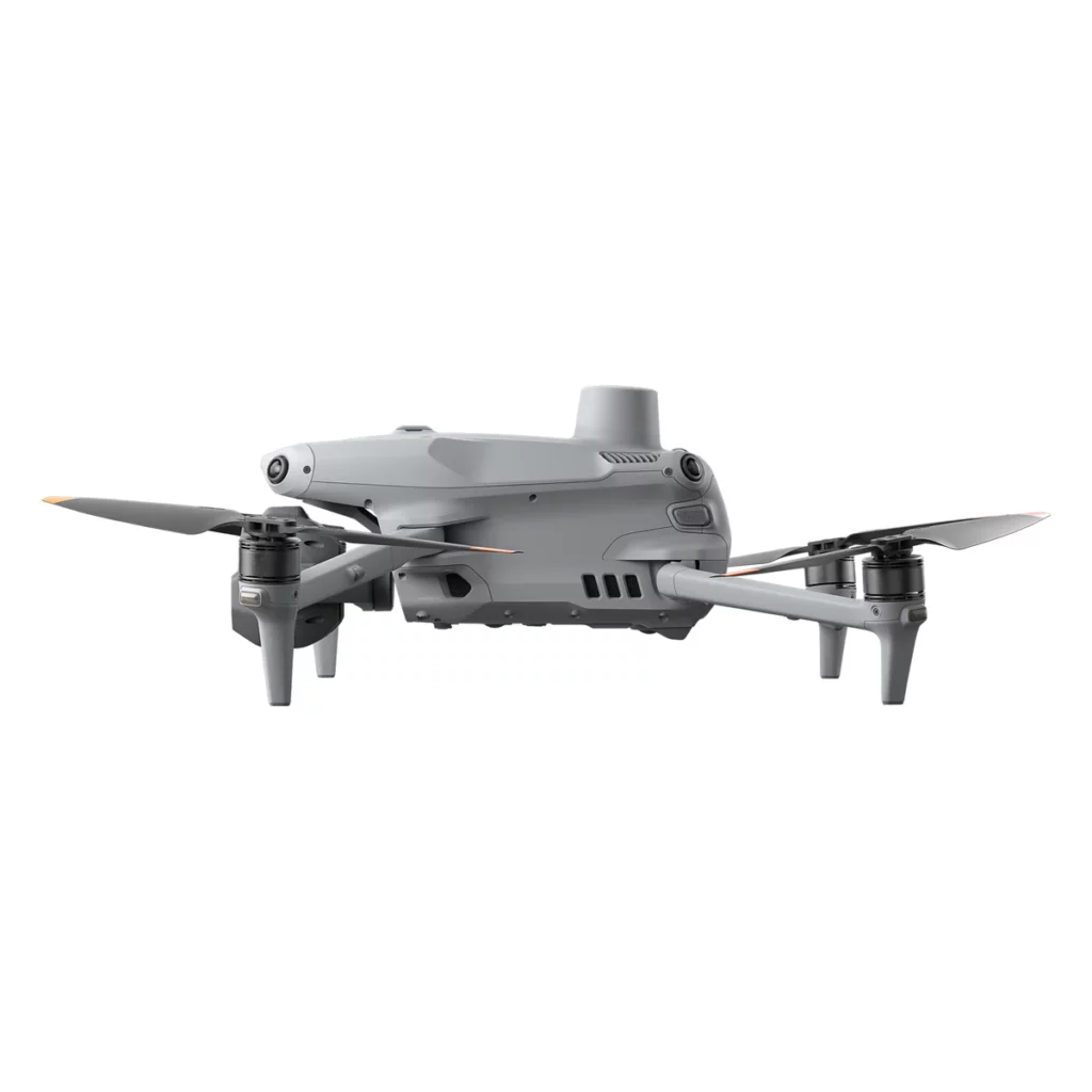
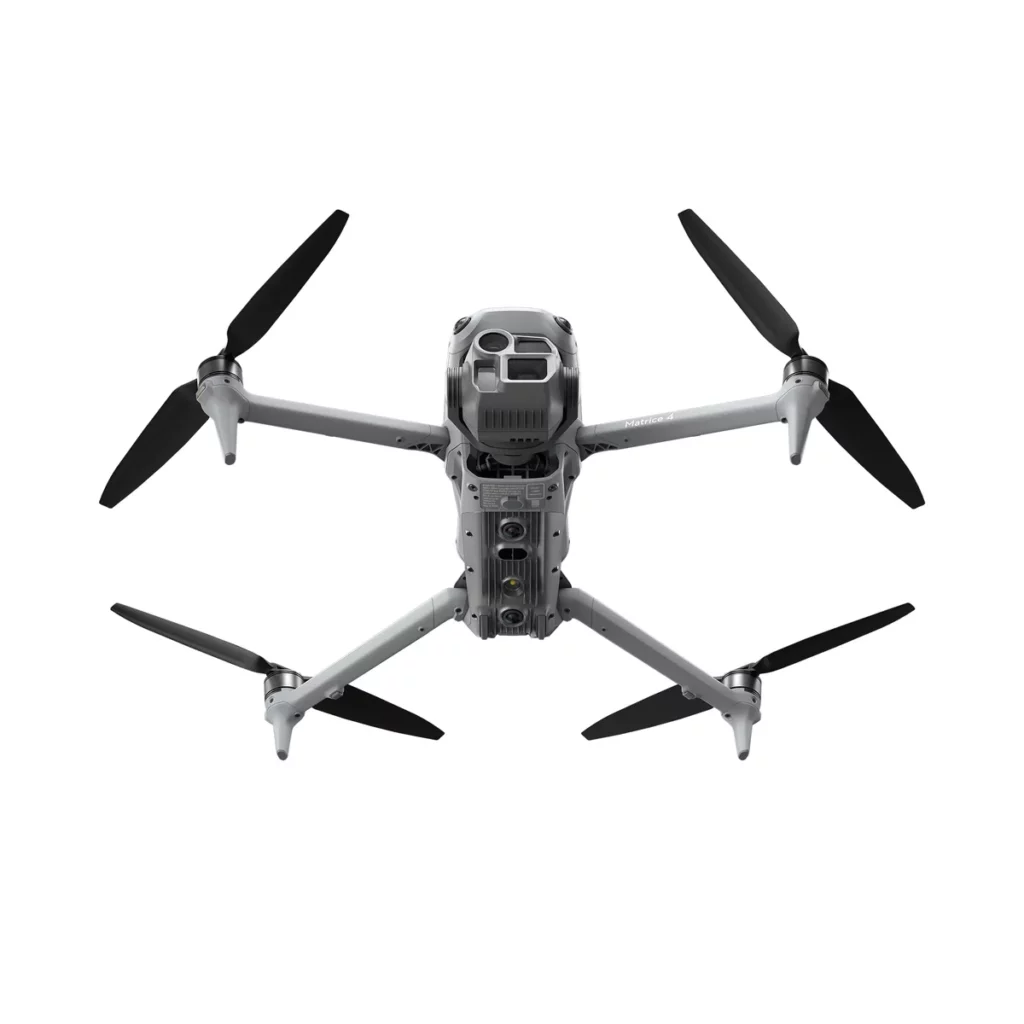
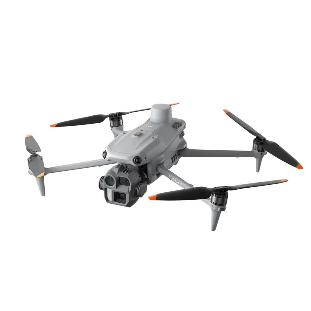
The DJI Matrice 4E (M4E) is a next-generation enterprise drone engineered to meet the demands of mapping, surveying, and industrial inspection. With its lightweight yet powerful design, advanced imaging system, and extended endurance, the M4E delivers professional-grade performance for organizations that require accuracy, efficiency, and adaptability in the field.
Designed as part of DJI’s Matrice 4 Series, this UAV offers a perfect balance between portability and enterprise-level functionality, making it a versatile tool for industries like construction, agriculture, utilities, public safety, and surveying.
Key Features of the DJI Matrice 4E
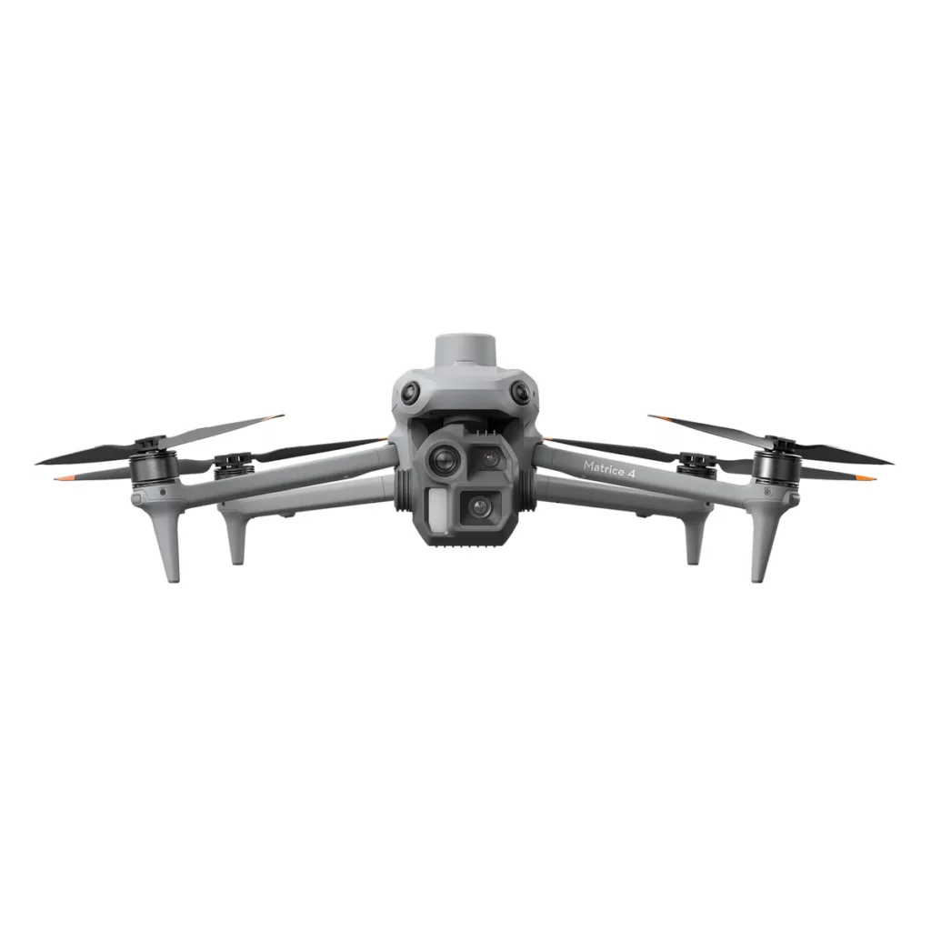
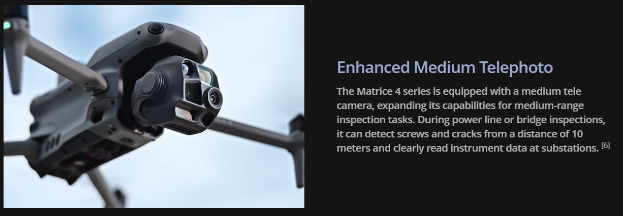
Advanced Imaging and Mapping Capabilities
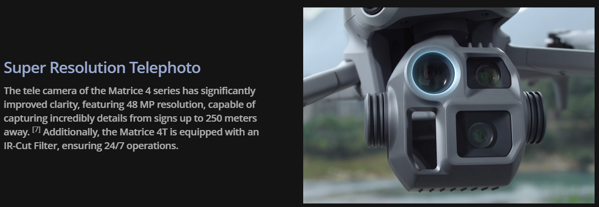
The Matrice 4E comes equipped with a high-resolution wide camera (20 MP, 4/3-inch CMOS sensor) and medium telephoto module (48 MP), delivering detailed imagery for surveying and inspection tasks. Its ability to capture centimeter-level accurate data ensures reliability for mapping, photogrammetry, and detailed reporting.
Enterprise-Grade Flight Endurance
With a maximum flight time of up to 49 minutes (standard propellers), the M4E enables longer missions with fewer interruptions. This endurance is ideal for large-scale mapping projects, infrastructure inspections, and agricultural surveys, reducing operational downtime and costs.
Precision and RTK Accuracy
The M4E integrates DJI’s advanced RTK technology, offering centimeter-level positioning. This ensures superior accuracy for surveying, mapping, and construction projects where precision is critical. RTK support also enhances flight stability in challenging environments.
Intelligent and Automated Operations
Built with DJI’s enterprise-level intelligent flight modes, the M4E streamlines repetitive tasks such as automated flight planning, terrain-follow missions, and waypoint inspections. These smart features increase efficiency, reduce pilot workload, and ensure data consistency.
Flexible Payload System
While the Matrice 4E focuses on optimized mapping and surveying payloads, it maintains compatibility with DJI’s Payload SDK. This allows for integration with specialized third-party sensors and equipment, expanding use cases to include environmental monitoring, emergency response, and infrastructure inspection.
Enhanced Flight Safety
The drone incorporates multi-directional obstacle sensing and positioning systems, ensuring safe operation even in complex environments. With precision hovering, wind resistance up to 12 m/s, and redundancy systems, the M4E provides reliable performance across varied conditions.
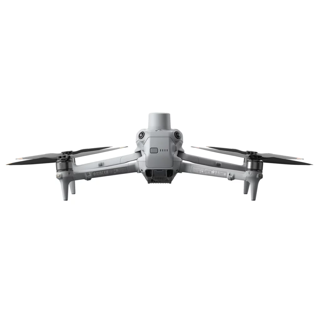
Rugged and Reliable Design
Compact and durable, the Matrice 4E is built to withstand demanding missions. Its robust airframe, weather-resistant design, and lightweight portability allow professionals to deploy quickly and operate efficiently in diverse field conditions.
Expandable Ecosystem
The M4E connects seamlessly to DJI’s enterprise ecosystem, supporting Cloud API integration for data workflows, and Payload SDK for sensor flexibility. This ecosystem makes it adaptable to a broad range of industry-specific applications.
Elevate Professional Operations with the DJI Matrice 4E
From surveying vast agricultural fields to monitoring infrastructure and utilities, the DJI Matrice 4E offers a professional solution that combines endurance, precision, and imaging excellence. Its modular design, RTK precision, and intelligent features make it an essential tool for enterprises that require reliable aerial data.
Whether you are a surveyor, engineer, inspector, or public safety professional, the M4E is designed to simplify your workflow and deliver results you can trust.
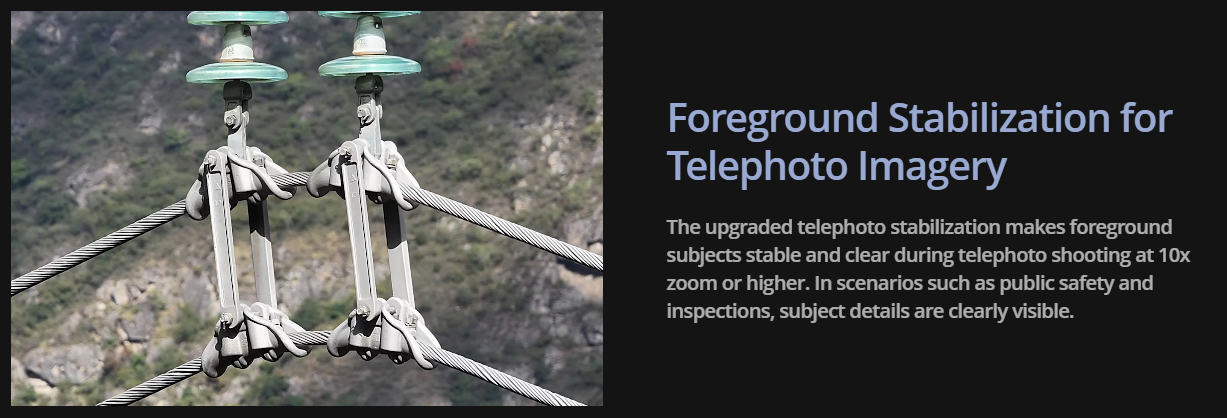
Capture Every Detail at A Distance
Tech Specs
Aircraft Specifications
Camera Specifications
Gimbal / Stabilization
Battery & Power
Other Features & Miscellany
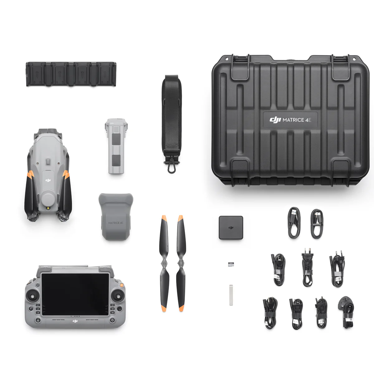
In the Box

DJI Matrice 4E Aircraft
x1

DJI Matrice 4 Series Battery
x1

DJI RC Plus 2 Enterprise
x1

DJI 100W USB-C Power Adapter
x1

DJI Matrice 4 Series Charging Hub
x1

microSD Card
x1

DJI Matrice 4E Gimbal Protector
x1

DJI Celllular Dongle 2 Pry Bar
x1

DJI Matrice 4 Series Propellers
x3

100W Power Adaptor AC Cable
x1

USB-C to USB-C Data Cable
x1

USB-A to USB-C Data Cable
x1

DJI Matrice 4 Series Storage Case
x1
