DJI Mavic 3 Multispectral for Precision Agriculture Drone (M3M)
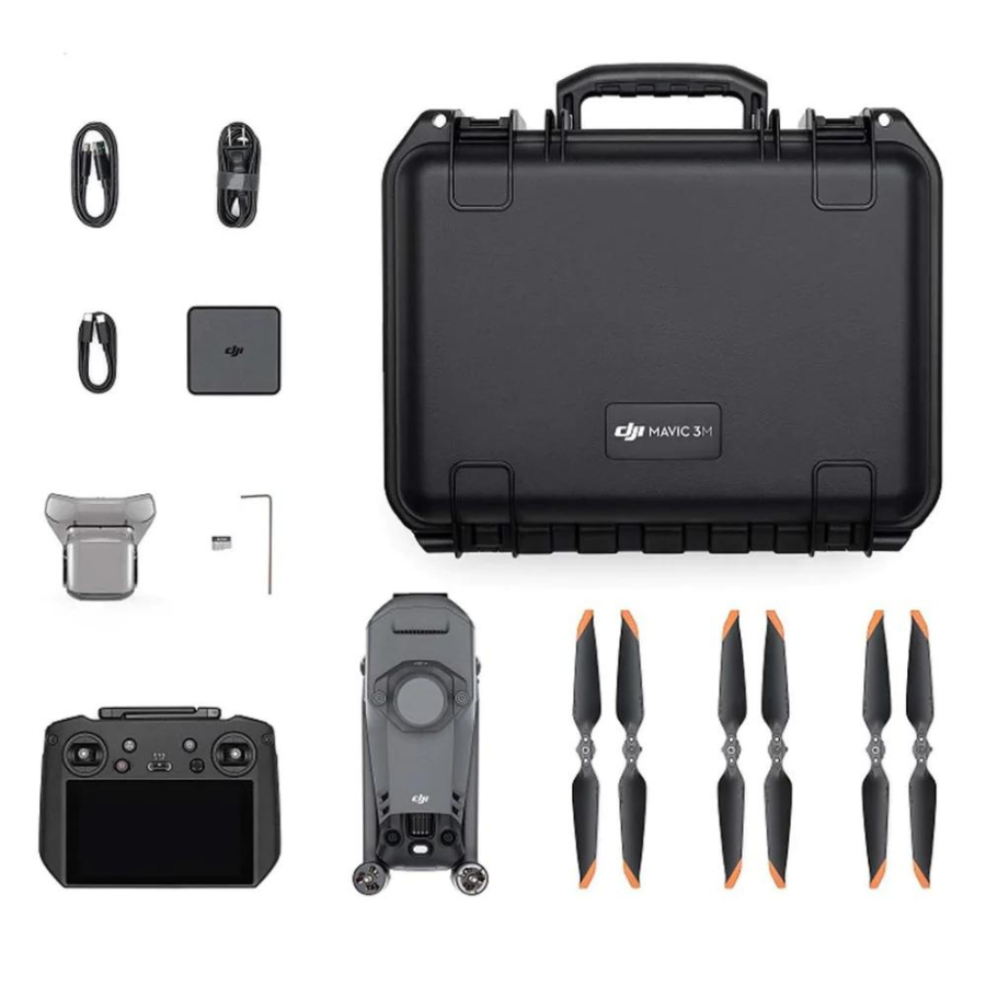
DJI Mavic 3 Multispectral for Precision Agriculture Drone (M3M)
Shipped worldwide. In India, available only to authorised entities. See eligibility →
1 Year
Warranty
7 Days
Replacement
In House
Repairs
Sealed
Packed
NDVI-ready
imaging.
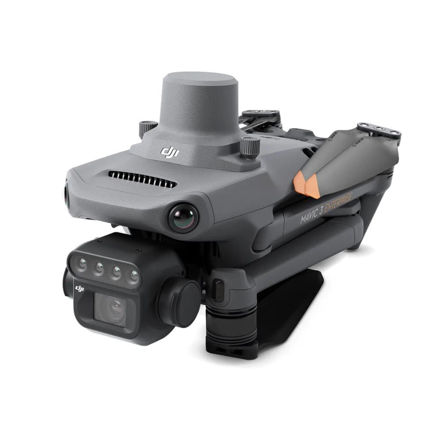
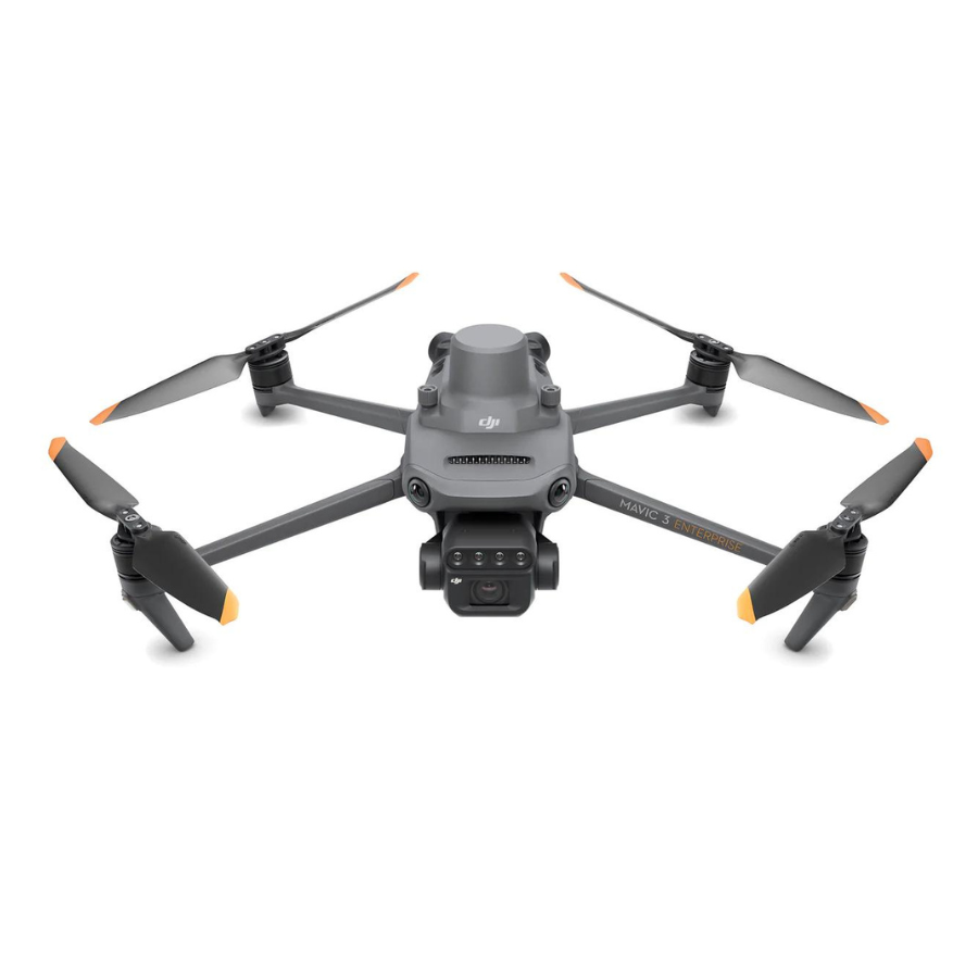
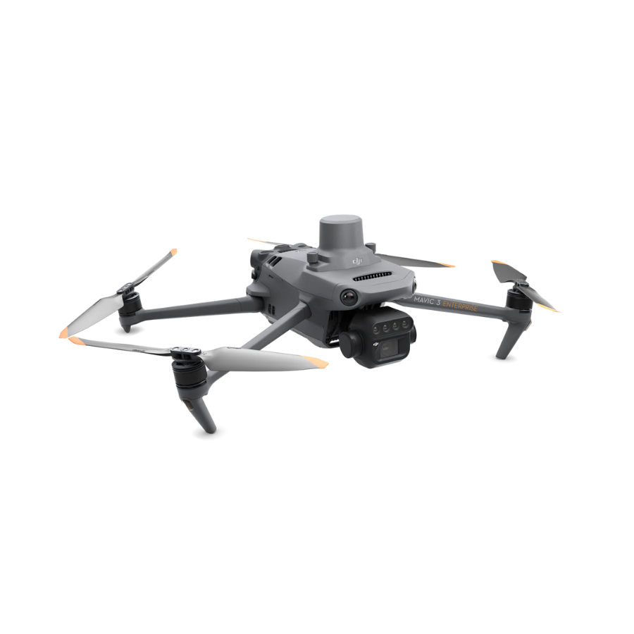
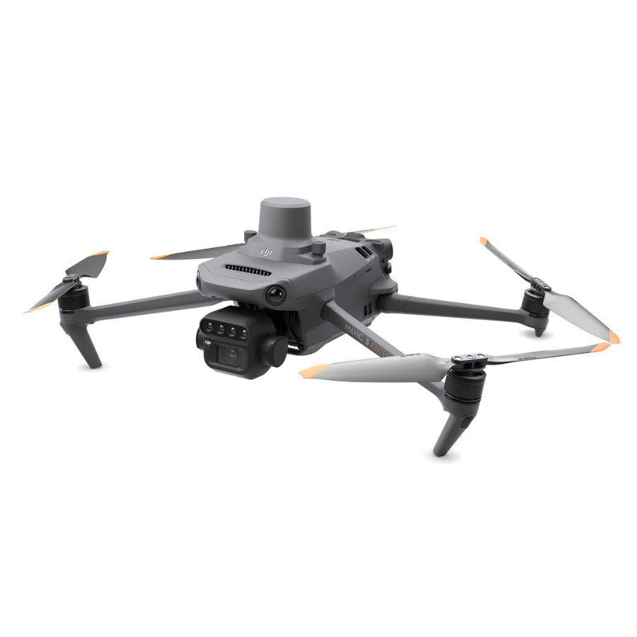
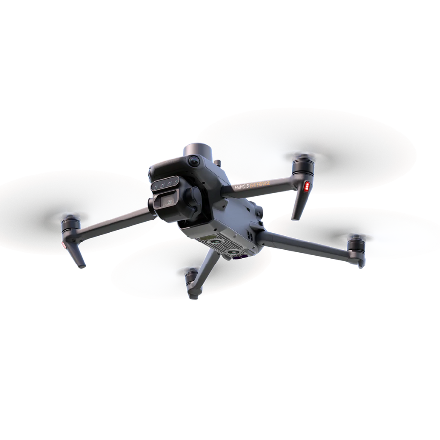
The M3M is purpose-built for precision agriculture. Four narrow-band multispectral cameras (Green 560nm, Red 650nm, Red Edge 730nm, Near-Infrared 860nm) plus a 20MP 4/3-inch RGB camera, all on the same gimbal, all firing simultaneously. Generate NDVI, NDRE, GNDVI, and custom vegetation indices for crop health monitoring at 909 g. RTK module delivers centimetre positioning for repeat-flight comparison across the season — the same field, week-on-week, geometrically aligned.
Four narrow bands.
Each 5 MP.
Four 5 MP global-shutter sensors capture Green (560 nm ±16 nm), Red (650 nm ±16 nm), Red Edge (730 nm ±16 nm), and Near-Infrared (860 nm ±26 nm) in a single exposure. Same instant. Same geometry. The narrow-band design means cleaner vegetation index outputs than what you get from broadband cameras with software interpolation. Sun light sensor on top of the aircraft logs solar radiance during flight for accurate radiometric calibration during processing.
4/3 CMOS.
20 MP. 5.1K video.
Companion 4/3-inch 20 MP RGB camera with f/2.8 lens captures aerial photography and 5.1K video alongside the multispectral data — meaning one flight delivers both the visual outputs (presentation imagery, drone footage) and the analytical outputs (NDVI maps). Mechanical shutter at 1/2000s eliminates rolling shutter distortion. Same gimbal, same position log, same flight — no second pass required for visuals.
Field to map
in one app.
DJI Terra Agriculture imports M3M flights and outputs NDVI, NDRE, GNDVI, OSAVI, LCI, and custom vegetation indices alongside high-resolution RGB ortho mosaics. Pix4Dfields, Agisoft Metashape, and DroneDeploy all process M3M data natively. Combined with RTK positioning, repeat-flights of the same field weeks apart align automatically — meaning you can track crop progression with confidence rather than guesswork. Outputs feed directly into farm management software (FieldView, Granular, Trimble Ag).
45 min.
6,000 m ceiling.
45-minute flight time per battery — long enough to cover 200+ hectares per flight at appropriate mapping altitude with multispectral overlap. 6,000 m max take-off altitude makes the M3M operational for high-altitude orchards (apple, walnut, kiwi) in Himachal, Uttarakhand, and Kashmir. OcuSync 3.0 transmission to 15 km. Wind resistance 10.7 m/s. Operating range -10°C to 40°C suits Indian growing seasons across most of the country.
Every angle.
→ Swipe to scroll
M3M vs P4 Multispectral.
Phantom 4 Multispectral
Previous-gen ag drone (EOL)
Mavic 3 Multispectral
Current-gen ag drone
Need to know.
What's the difference between NDVI and NDRE? +
Both are vegetation indices computed from multispectral bands. NDVI uses (NIR − Red) / (NIR + Red) and is the most widely-used indicator of overall plant biomass and chlorophyll content. NDRE uses (NIR − Red Edge) / (NIR + Red Edge) and is more sensitive to subtle chlorophyll variations in mature canopies, where NDVI saturates. The M3M captures all four bands simultaneously, so you can compute both indices (and others — GNDVI, LCI, OSAVI, custom formulas) from the same flight. DJI Terra Agriculture handles the math; you just choose which output you need.
How big a field can the M3M map per flight? +
Roughly 200 hectares per battery at 100 m altitude with 75% forward / 65% side overlap, depending on wind and battery condition. With multiple batteries (the kit includes 3-4 spares typically), full-day operation can comfortably cover 800-1,000 hectares — large enough for sugarcane estates, vineyards, and corporate farms. For smaller farms (under 50 ha), one flight covers everything with margin for re-shoots.
Does it integrate with FieldView, Granular, or DJI Agras? +
M3M data exports as standard GeoTIFF, KML, and shapefile formats from DJI Terra Agriculture — directly importable to Climate FieldView, Granular, Trimble Ag, John Deere Operations Center, and FarmLogs. For DJI Agras spraying drones (T20P, T30, T50), prescription maps generated from M3M data load directly via DJI SmartFarm — closing the loop between detection (M3M) and treatment (Agras) without manual data conversion.
Is the M3M DGCA-compliant? +
The M3M takes off at 909 g — DGCA Small class (250 g to 2 kg). Requires Digital Sky registration (UIN) and Remote Pilot Certificate (RPC) for commercial agricultural use. Sold to authorised entities: agricultural cooperatives, FPOs, state agricultural universities, licensed agronomy service providers, and corporate farms. Our team handles registration and import documentation, and we offer pilot training programs for agronomy teams transitioning to multispectral imaging.
Warranty and after-sales support +
1-year DJI manufacturer warranty on aircraft and DJI accessories. 7-day replacement on manufacturing defects. DJI Care Enterprise covers crash damage. All servicing and pilot training at our in-house facility in Sector 66 Gurgaon. We also assist with DJI Terra Agriculture licensing and workflow setup for first-time multispectral users.
