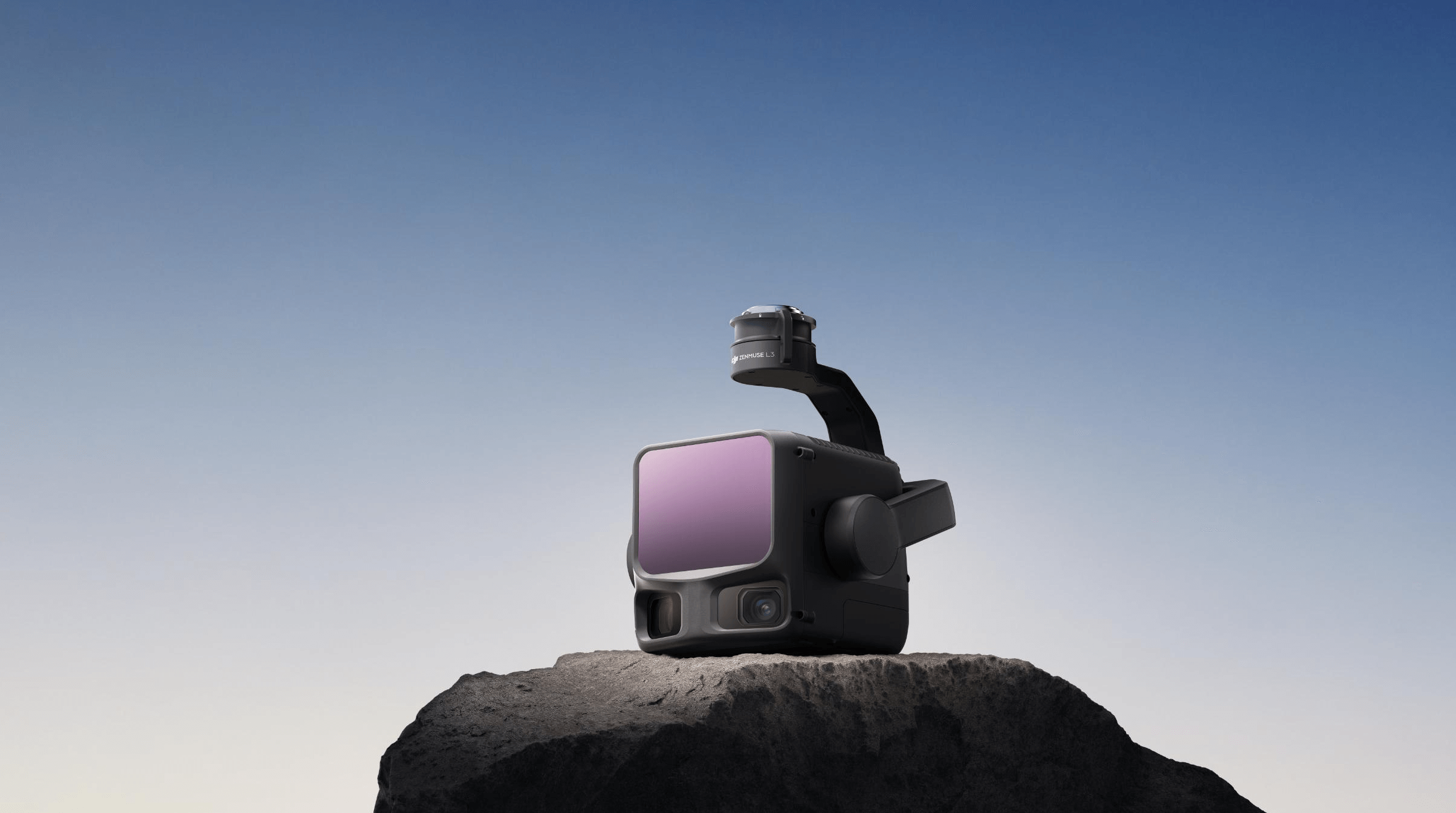
DJI Zenmuse L3
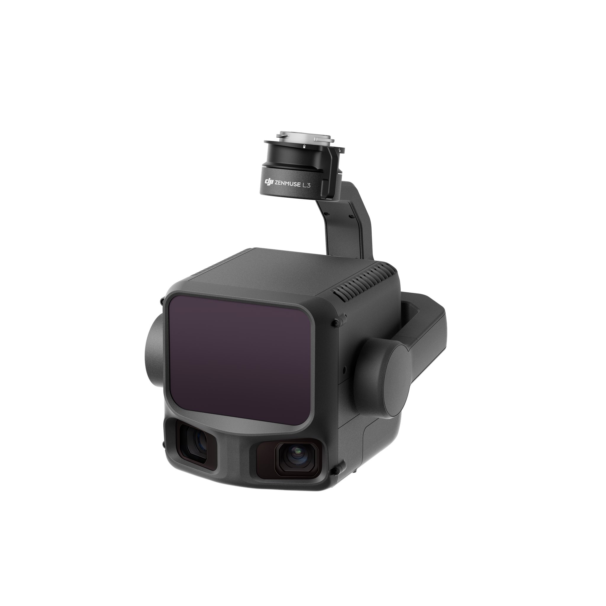
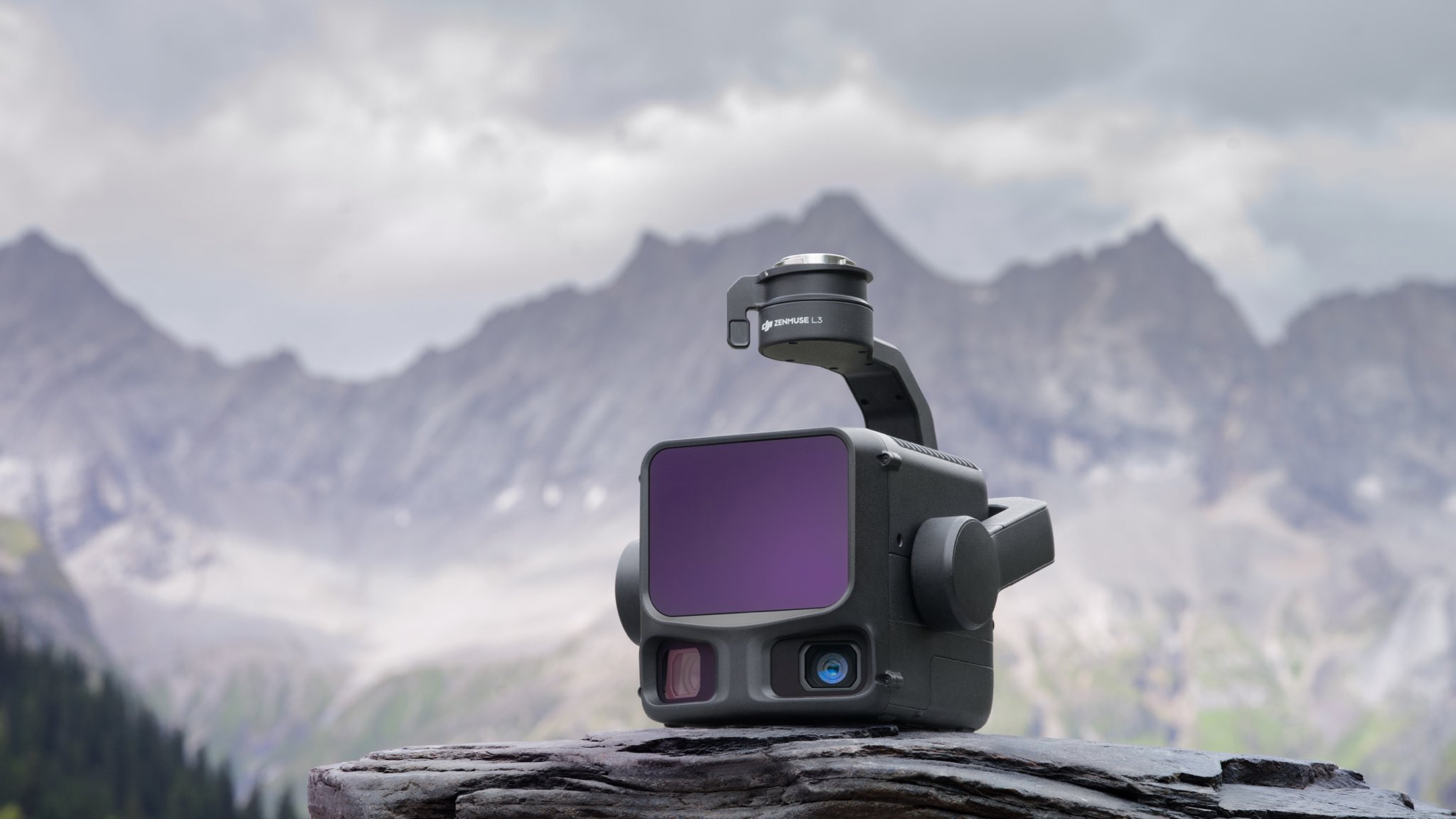
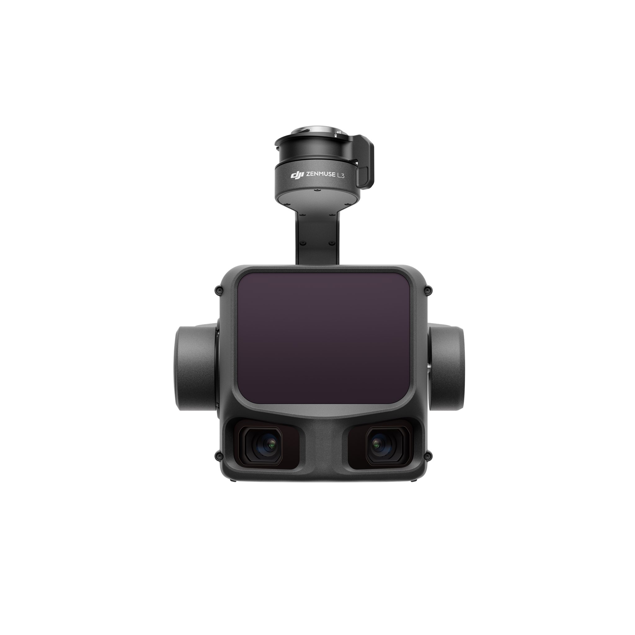
DJI Zenmuse L3
1 Year
Warranty
7 Days
Replacement
In House
Repairs
Sealed
Packed
950 metres at 10% reflectivity.
2000 metres at 80%.
Released November 4, 2025 as DJI's first long-range, high-accuracy aerial LiDAR. The 1535nm wavelength enables substantially longer detection range than the 905nm systems (L1, L2) while maintaining Class 1 eye-safety. Detection ranges: 950m at 10% reflectivity (100 kHz pulse), 700m at 10% (350 kHz), 2000m at 80% (100 kHz). Laser beam divergence 0.25 mrad — laser spot size at the same range is approximately one-fifth that of the L2. The wavelength shift is the engineering achievement; the operational consequence is mapping at higher altitudes with the same point density.
Variable pulse rate.
100 kHz to 2 MHz.
Laser pulse emission frequency is adjustable across four modes: 100 kHz (recommended <500m altitude), 350 kHz (<300m), 1000 kHz (<100m), 2000 kHz (<50m). Higher pulse rates trade range for point density. Number of returns scales with pulse rate: 16 returns at 100 kHz or 350 kHz, 8 returns at 1000 kHz, 4 returns at 2000 kHz. Star-shaped, Linear, and Non-Repetitive scanning modes. Cross-cycle calculation 7×. The variable pulse rate is what makes L3 a single payload for missions from 50m corridor scans up to 500m+ regional surveys.
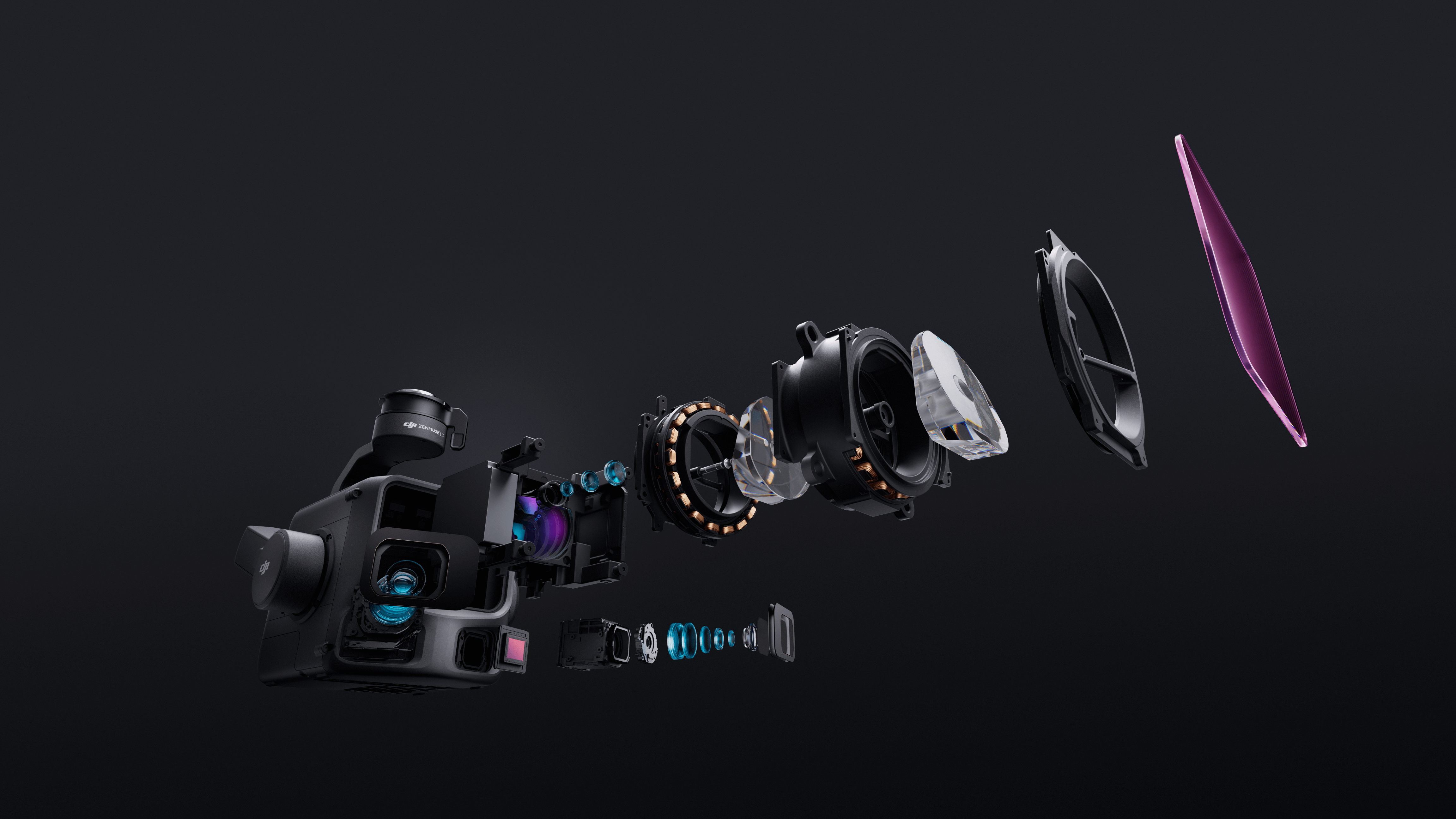
Two Four Thirds sensors.
107° combined FOV.
Dual 100 MP Micro Four Thirds CMOS RGB mapping cameras at 28mm equivalent focal length, aperture f/2.0 to f/11. The two sensors mount at a 45° optical axis angle, combining for 107° horizontal field of view per capture — broader area coverage per flight pass. Mechanical shutter rated 500,000 cycles. At 300m flight altitude the dual-sensor system achieves 3cm ground sample distance (GSD). Photo sizes 100 MP (12288×8192) or 25 MP (6144×4096). Min photo interval 1s for 100 MP JPEG.
3 cm vertical @ 120 m.
5 cm @ 300 m.
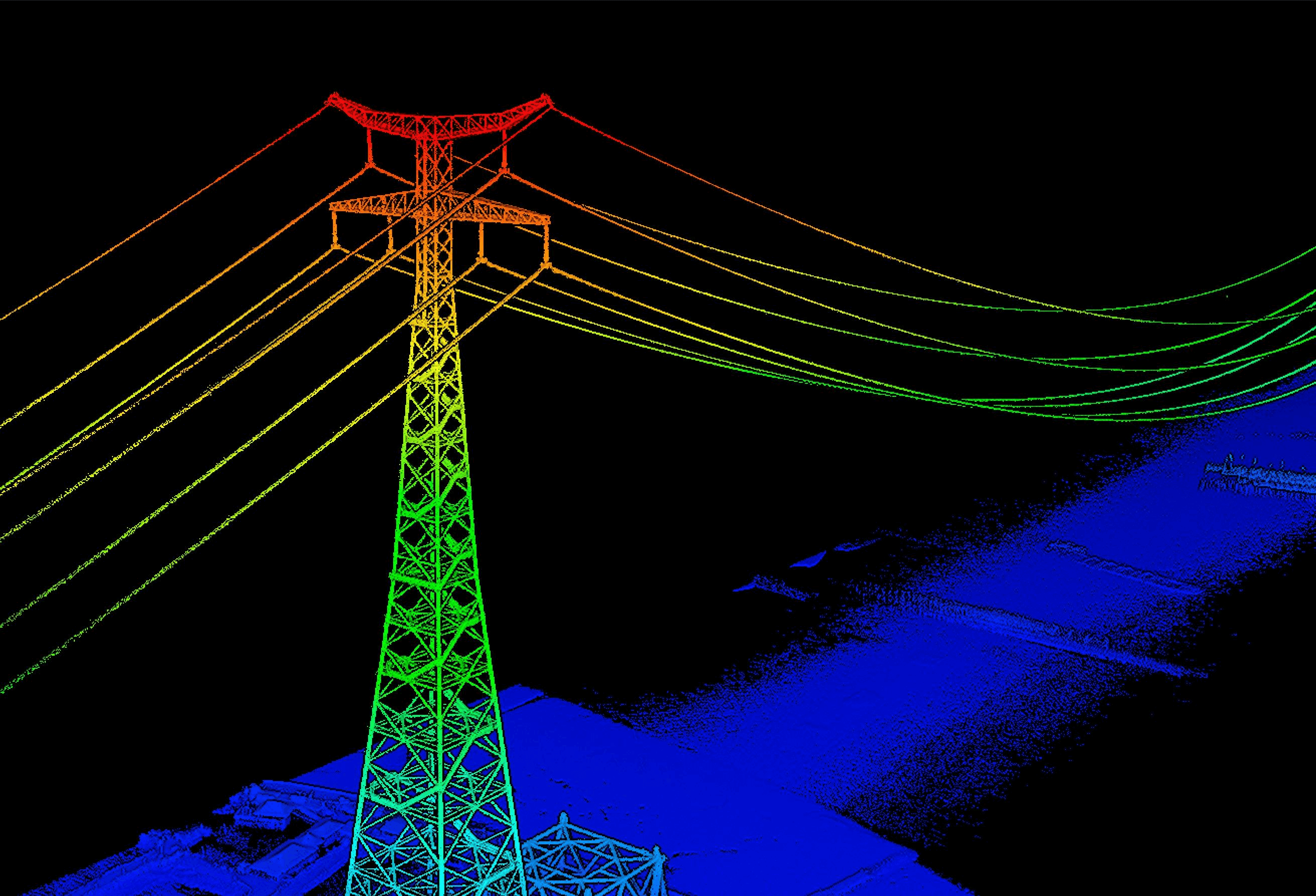
Point cloud system accuracy at 120m flight altitude: 3cm vertical, 4cm horizontal RMSE. At 300m flight altitude: 5cm vertical, 7.5cm horizontal. Point cloud thickness at 120m nadir flight: 1.2cm at 1σ. Ranging absolute accuracy ±10mm, repeatability <5mm at 1σ. Sufficient for mapping at 1:500, 1:1000, and 1:2000 scales — the surveying-standard scales for cadastral, urban planning, and engineering deliverables. For 1:500 work the L3 currently sets the consumer-accessible benchmark.
10 km² per flight.
100 km² per day.
When mounted on the Matrice 400 at typical 300m flight altitude, a single flight covers up to 10 km². Daily coverage up to 100 km² achievable across multiple flights with even a 20% LiDAR side overlap ratio. Simultaneous LiDAR and RGB capture means each mission produces digital orthophoto maps (DOM), digital elevation models (DEM), and colourised point clouds from a single flight — no need for separate photogrammetry and LiDAR passes. The efficiency gain is substantial for state-level mapping programmes and large infrastructure surveys.
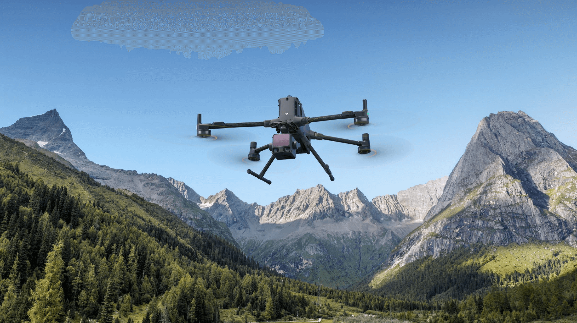
Matrice 400 only.
Single gimbal connector required.
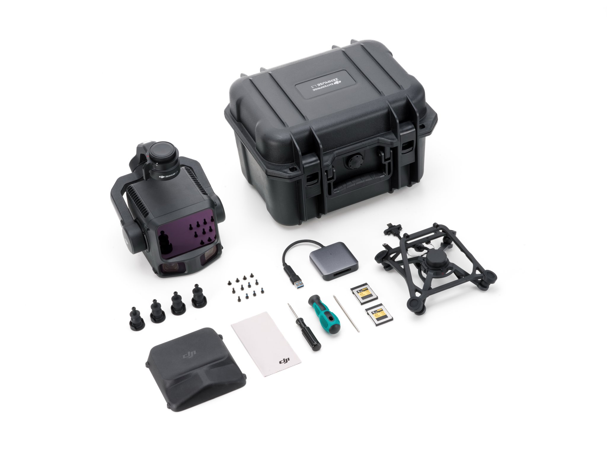
Zenmuse L3 mounts only on the Matrice 400 airframe via the Zenmuse L3 single gimbal connector (145g, sold separately as part of the deployment kit). The connector is what enables the higher power budget (100W peak) and data throughput the L3 needs. Honest constraint: this is a flagship pairing — L3 is not retrofittable to existing M350 RTK or M300 RTK fleets. Buyers planning L3 deployment should plan the M400 airframe purchase simultaneously.
Flagship detail.
→ Swipe to scroll
L3 vs L2.
Zenmuse L2
Mid-range LiDAR
Zenmuse L3
Long-range flagship
Supported aircraft.
Confirm current firmware compatibility on DJI's official compatibility page before purchase. Firmware updates can extend compatibility.
Full specifications.
Need to know.
Why pick L3 over L2?+
Three honest reasons. (1) Long-range operations — if your surveys regularly happen above 300m AGL, L3's 1535nm wavelength and variable pulse rate are mission-critical; L2 falls off in accuracy at those altitudes. (2) Coverage demands — 100 km² per day vs L2's 2.5 km² per flight is a 10× efficiency gain for large area mapping. (3) Survey-grade scale requirements — 1:500 mapping needs L3's 3cm vertical accuracy. Outside these cases, L2 is the operationally sensible choice — it works on M300/M350 fleets, costs less, and handles the vast majority of professional survey work. L3 is the flagship for state-level mapping programmes, large transportation corridor surveys, and forestry inventories at national scale.
L3 only mounts on Matrice 400 — what does this mean for fleet planning?+
If you don't already operate an M400 airframe, plan the L3 deployment as a coordinated payload + airframe purchase. The L3 single gimbal connector is required (145g, listed separately). The M400 + L3 + DJI RC Plus + connector + spare batteries kit is the realistic minimum spec. For organisations standardising fleet on M350 RTK, L2 remains the supported LiDAR. The M400 transition is the right move if your survey volumes justify L3's productivity — typically 50+ km² per month sustained.
Software ecosystem and workflow?+
End-to-end DJI pipeline: DJI Pilot 2 for flight planning (Area Route with Linear, Star-Shaped, or Non-Repetitive scan modes), data capture to CFexpress Type B (1500 MB/s write — important for the high data rates the dual 100MP cameras + LiDAR generate). Post-processing in DJI Terra with Optimize Point Cloud Accuracy. DJI Modify for point cloud editing. DJI FlightHub 2 for cloud-based fleet management and data sharing. Exports in standard formats — PNTS, LAS, LAZ, PLY, PCD, S3MB — for downstream survey software including TerraSolid, Trimble Business Center, LiDAR360, and CloudCompare.
DGCA approval for large-area aerial mapping in India?+
Standard RPC + Digital Sky registration for commercial UAS work. M400 airframe Type Certificate required. Operations above 120m AGL require DGCA-issued UTM coordination. Large-area mapping flights commonly cross multiple administrative zones — plan multi-zone clearance well in advance. Cadastral mapping additionally requires state revenue department concurrence. State-level mapping programmes typically also coordinate with Survey of India (SoI). The 1535nm LiDAR remains Class 1 eye-safe — no Class A laser concerns. Jetayu can advise on documentation specific to your operation type, including assistance with multi-state survey approvals.
Warranty and service+
1-year DJI manufacturer warranty, 7-day replacement on manufacturing defects, and optional AMC for accidental damage. All repairs at our in-house facility in Sector 66 Gurgaon. Enterprise buyers can also enquire about on-site commissioning and operator training as part of the procurement package.
