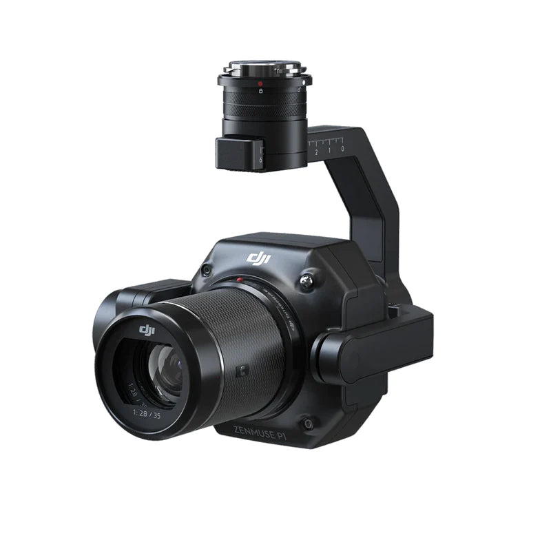
DJI Zenmuse P1


DJI Zenmuse P1
1 Year
Warranty
7 Days
Replacement
In House
Repairs
Sealed
Packed
35.9 × 24 mm sensor.
4.4 μm pixel pitch.
The P1's image sensor is 35.9 × 24 mm — full-frame, the same physical sensor size as a Sony A7R IV or Nikon Z7. 45 megapixels at 4.4 μm pixel pitch. For aerial photogrammetry that pixel size matters: it sets the ground sample distance (GSD) you can resolve at a given flight altitude. GSD = altitude / focal-length multiplier — 1 cm GSD at 55m with the 24mm lens. Three DL primes (24/35/50mm) cover GSD targets from broad orthophoto to detailed structural surveys.
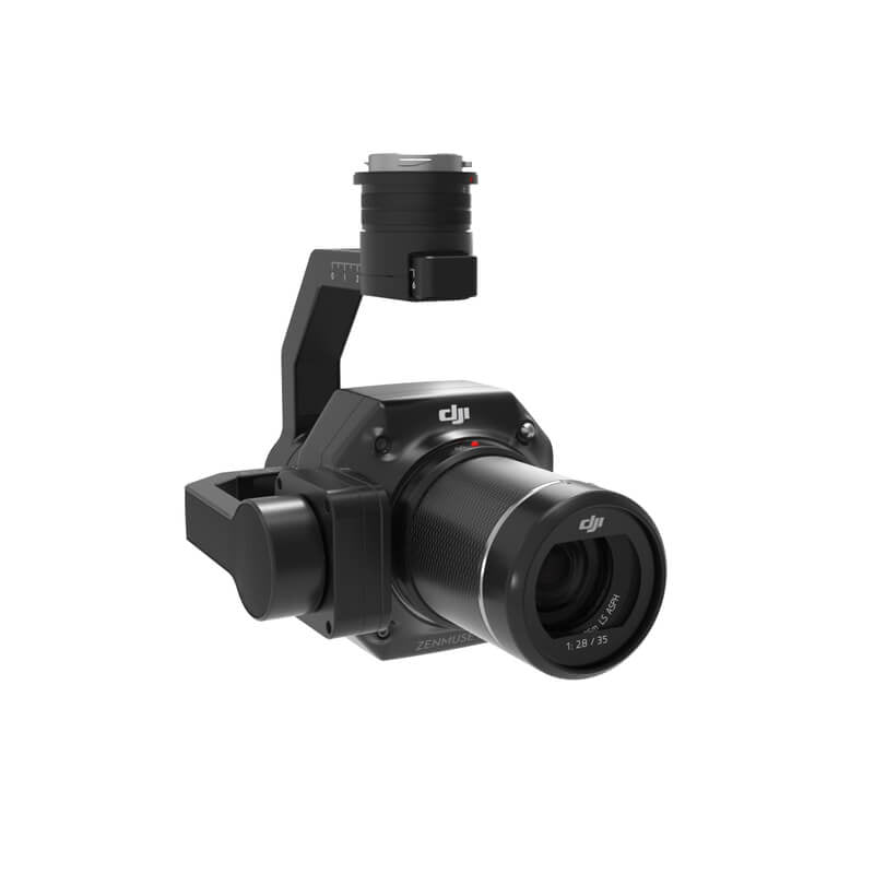
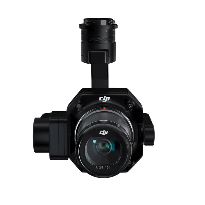
24mm / 35mm / 50mm.
F2.8 LS ASPH primes.
Three interchangeable DJI DL fixed-focus primes designed specifically for aerial photogrammetry: DL 24mm F2.8 LS ASPH (84° FOV, GSD = altitude/55), DL 35mm F2.8 LS ASPH (63.5° FOV, GSD = altitude/80), DL 50mm F2.8 LS ASPH (46.8° FOV, GSD = altitude/120). Each lens ships with hood and balancing ring. Optical parameters and performance characteristics are written to image metadata for downstream surveying software — Pix4Dmapper, Bentley ContextCapture, Agisoft Metashape all read the lens-calibration data directly.

Microsecond synchronisation.
Exit-pupil position written per shot.
TimeSync 2.0 synchronises the P1's camera, gimbal, flight controller, and RTK module to microsecond accuracy. Each photo's exposure timestamp writes to the image metadata with the precise exit-pupil position of the lens — not the drone position, the actual sensor-plane optical centre — calculated from drone position + gimbal orientation + lens optical characteristics. For PPK post-processing, this eliminates one of the largest sources of error in aerial photogrammetry: ambiguity about where the camera actually was when it triggered.
Five-angle automation.
Nadir, front, left, back, right.
Smart Oblique Capture automates oblique photogrammetry flights — the gimbal pivots to nadir, front-oblique, left-oblique, back-oblique, and right-oblique angles in a programmed sequence. Tilt range during oblique capture is -60° to -90°. Result: 7.5 km² covered in a single working day, 20-50% reduction in post-processing time versus manual oblique passes. Designed specifically for 3D reality model generation used in urban planning, smart-city work, and detailed building modelling.

1/2000 s.
Zero rolling-shutter artefacts.
Global mechanical shutter at 1/2000s — every pixel of the sensor exposes simultaneously. Critical for aerial photogrammetry: rolling shutter on moving platforms warps building façades and creates trapezoidal artefacts in oblique imagery. Global shutter eliminates this entirely. Photo interval as short as 0.7s allows for continuous-capture survey patterns at typical mapping flight speeds. Mechanical shutter rated to standard duty cycles — for high-volume survey operations the shutter is the maintenance item to plan for.
3 cm horizontal.
5 cm vertical. No GCPs needed.
Absolute accuracy without ground control points: 3 cm horizontal, 5 cm vertical. Measured at 3 cm GSD with 75% front overlap and 55% side overlap at 15 m/s. That's sufficient accuracy for cadastral surveying, urban-planning orthomosaics, infrastructure asset audits, and most engineering site surveys. For survey-grade work requiring tighter tolerances, ground control points push accuracy below 2 cm. Single-flight coverage 3 km² at standard photogrammetry altitudes.

Module detail.
→ Swipe to scroll
P1 vs L2 — what's the call?
Zenmuse P1
Visual photogrammetry
Zenmuse L2
LiDAR + RGB photogrammetry
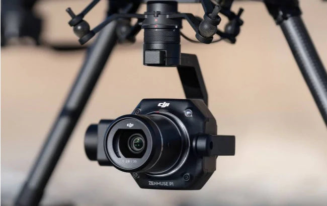
Supported aircraft.
Confirm current firmware compatibility on DJI's official compatibility page before purchase. Firmware updates can extend compatibility.
Full specifications.
Need to know.
P1 vs L2 — which one for my application?+
P1 if your deliverable is visual: high-resolution orthomosaics, 3D reality models from photogrammetry, cadastral surveys, urban planning models, building-envelope inspections. L2 if your deliverable requires terrain or canopy penetration: forestry inventories (canopy height, biomass), terrain modelling in vegetated areas, sub-canopy mapping, power-line corridor surveys where wires need direct detection. The honest framing: P1 captures what's visible; L2 captures geometry including what's hidden behind foliage.
Software workflow with Pix4D and other third-party tools?+
P1's TimeSync 2.0 metadata writes exit-pupil positions directly to image EXIF — Pix4Dmapper reads this natively as 'optical centre' for bundle adjustment. Bentley ContextCapture and Agisoft Metashape similarly support DJI's metadata format. For PPK workflow with M300 RTK: TimeStamps.MRK files generated alongside photos can be post-processed in Pix4D's PIX4Dmatic or Trimble Business Center. The cleanest pipeline remains DJI Pilot for flight planning → DJI Terra for orthomosaic/3D processing → export to your survey GIS.
Drone compatibility — what works?+
Per DJI's current support documentation: Matrice 300 RTK (original launch platform, single gimbal port required), Matrice 350 RTK, and Matrice 400. Earlier DJI documentation states M300 RTK only — that's outdated; the current support page confirms M350 RTK and M400 are supported. If you're standardised on Matrice 30 series, P1 will not mount; consider the M3D as a smaller-sensor alternative.
DGCA approval for aerial photogrammetry in India?+
Standard RPC + Digital Sky registration for commercial UAS. Type Certificate required for the aircraft. Photogrammetry survey flights are typically in green zones at flight altitudes 60-150m AGL — green zone authorisation through Digital Sky. For surveying sensitive areas (defence land, critical infrastructure, contested boundaries) you'll need DGCA Yellow Zone permission plus the local authority's site-specific clearance. Cadastral surveys typically also require state revenue department concurrence. Jetayu can advise on documentation specific to your operation type.
Warranty and service+
1-year DJI manufacturer warranty, 7-day replacement on manufacturing defects, and optional AMC for accidental damage. All repairs at our in-house facility in Sector 66 Gurgaon. Enterprise buyers can also enquire about on-site commissioning and operator training as part of the procurement package.
